Categories
australia bikes climbing general hiking moosling trip reports

Australia Part 3: Arapiles days continued…

Wednesday was a chance to revisit my childhood of stomping about in the Grampians. Well, not exactly all of my childhood, but rather some highly valued and infrequent childhood trips to the Grampians. Trips that instilled a love of rock hopping, scrambling about on rocks, and getting to the top of mountains –  which my parents may have come to regret as I took to rock climbing and then disappeared to live in the Canadian Rockies.

We went to hike up the Pinnacle, overlooking Halls Gap – I had distant memories of it being fun, and involving plenty of rock hopping. I was right!

It was a warm day (by Canadian standards anyway) (actually, by Australian standards too judging by the state of some of the other people out hiking). Al and Lincoln joined us hiking, while Brendan was off on a gravel grinding loop through the Grampians.

The rocks were numerous, and highly hoppable – Finn took to it all with great pleasure. We explored in two caves, and stuck our head in a waterfall – all helpful to cool down. The details of Alex’s heritage as a cave dweller were explored more thoroughly (apparently this all started while they were climbing at Bushranger’s Bluff), as we explained to Finn that one of these caves was where Papa had grown up.

At the summit we found a pet cicada, then it was eaten by a crow, and a harsh life lesson was learned by all.

We even went and tried the nerve test, and discovered that we have no nerves, and were totally fine with that.

Then back down to the carpark, and it was time for icecream for all in Halls Gap!

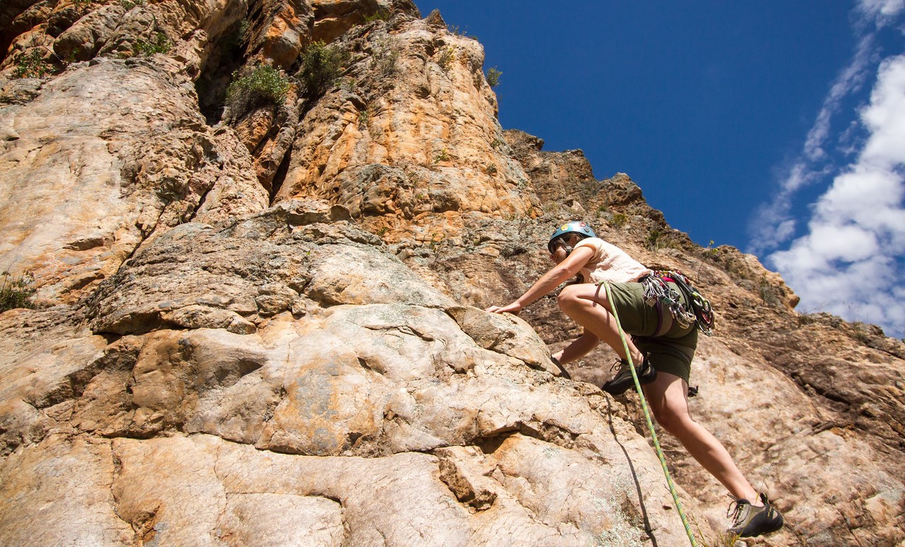
Thursday brought a pleasantly relaxing morning, followed by some relaxing climbing in the shade with Cath and Adam. I even got to frolic through a field of daisies on one of the climbs! All of the rain has done wonders for some of the cliff vegetation.

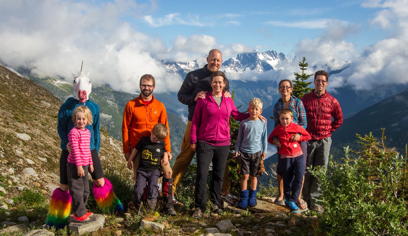
Smudge wasn’t a fan of the unicorn, but was a fan of trying to devour things that anyone is holding, even if they are a unicorn.

Lured out to ride a bike one more time (it’s notoriously difficult to get me to go for a ride, it tends to be as difficult as just suggesting one), I rode up to the summit of Arapiles with Brendan once again. When there’s nothing but plains all around, it’s far and away the most obvious spot to go – and has the added benefit that you can actually see the sunset!

Sundowner beer successfully drunk (dranken? drinked?), it was back to Andy’s to catch the tail end of roast dinner and more catching up with Brett and Sair who had arrived that afternoon.

Friday morning we all hit the Organ Pipes, now climbing with Sair for the first time in absolutely years.

Fun climbing times done, we headed into town to hang out at the cafe (blanket couches!), then it was time for goodbyes. Again. This was the downside of the Australia trip.

The afternoon plan was to go and visit the Little Desert National Park. I was dubious. We arrived in the desert. It was full of trees and plants. I proclaimed that my parent’s farm looks like more of a desert than this. #worstdesertever!

All the recent rain did at least mean there were pretty flowers to look at. However, our attempts at doing the guided desert walk were a bit of a failure – there were lots of numbered posts, and an accompanying informational brochure, but the majority of the flora of note seemed to have died in the meantime.

The hand lizard enjoyed making its way around the desert though.

And there’s nothing quite like deserted desert roads for jump shots. And photo bombing apparently.

Saturday brought yet more goodbyes, as the NZ crew disappeared. Cath and I got one more climb in at the Organ Pipes though, so that was lovely.

The afternoon was gainfully spent lazing in trees, hiking to the summit of the mount with Al and Lincoln, and sitting about in the Horsham pool. And catching a Snorlax – there was a lot of Pokemon catching on this trip.

Then it was Sunday, and time to leave. But not before a final bike ride to the summit!  Andy and I rode together until we hit the Arapiles road, then he sent me off to sprint to the summit, which I had great fun doing, thoroughly exhausting myself (and getting a couple of QOMs, woo).

Final Arapiles farewells were said to Al and Lincoln, and then to Andy, Ying and Smudge, who we’d been staying with for the past week (and had loaned bikes, and entertained the Moosling with an endlessly fascinating collection of Lego Technic creations).

And so, onwards, with just one week left in Australia, the van hit the road once again.

Categories
canada general hiking moosling snow

Mount St Piran: Yellow larches and snow

In larch season in the Rockies it’s pretty much obligatory to get out hiking. In general, September is hiking and trail running season. Tanya had invited us out to head out to hike the Devil’s Thumb, but once we all got to the Lake, the decision was made to go and do a proper summit – Mount St Piran it was. It was even in Kane’s Scrambles in the Canadian Rockies book!

First up is easy highway-style trails, the only challenge is traffic management as you hike in among so many other people.

But after we hiked past Mirror Lake at the foot of the Little Beehive, and past the turnoff to Lake Agnes, the crowds started to thin out.

As we started switch-backing up to the small saddle below the summit of Mount St Piran, it started to get snowy.  Well packed at first, but then increasingly slippery.

At the saddle, we finally met up with a group (from Rocky Mountain Adaptive?) who were helping get someone with a disability get to nearly the summit of Mount St Piran in one of their ‘TrailRider’ adapted one-wheel rugged weelchairs.

At the mini summit we paused for some photos and jumping, with the view down to Lake Louise below, looking resplendently turquoise.

Then it was onwards and upwards. Not far to the summit now!

The combination of cumulus clouds in the blue sky, snow-capped mountains, yellow larches, snowy terrain and Lake Louise were wonderfully beautiful. Also, hurrah for brightly coloured outdoor clothes – it makes for great photos.

The trail was much less well-packed to the summit, but it wasn’t far at all. It was a bit disconcerting though, as it was so poorly packed that you could still punch through the snow to a big talus hole.

Summit! And the wind had mostly died down enough that it was actually pretty pleasant. Amazing views, I can’t believe we’ve hiked so little here before (put off by the big crowds at the lakes below).

Then, to get down again, we’d decided to do a loop – back off the back of the mountain and down past Lake Agnes.

And because it was so beautiful, here are far too many photos from the descent.

As the terrain got steeper, it became more and more challenging.  Slippery. A lot of us slipped over at one time or another.  The boy decided he was better off with glissading the whole way, and thought the whole thing was amazingly fun, and way better than normal trails.

Glissading!  Thank goodness for waterproof pants!

We were hopeful that once we hit the saddle and left the snow, that it would be easier. But it was still tricky ground. Steep and loose, we switchbacked to and fro and I tried hard to convince the boy that he wasn’t allowed to just keep sliding down, as much as it might be really fun.

A few mountain goats hovered around on the slopes (not literally, although that would be awesome) – and watched us as we hiked by them.

Then finally, the terrain flattened out, and then we were at Lake Agnes, and back into the hiking crowds and larches.

The descent from there was fairly fast. And now the boy has two (the very easiest two I think) of the Kane scrambles under his belt.

And the added benefit of Lake Louise? There are plenty of pokestops and pokemon hanging out there if you’re hanging out waiting for people to arrive.

Distance: About 14.5km
Elevation gain: Around 900m
Time: About 6.5 hours
Figures in the map linked below are a little off, as we forgot to turn on the GPS straight away.

Categories
canada general hiking moosling trip reports

Stanley Mitchell hut trip

Another weekend, another hut trip – it must be summer in the Canadian Rockies.

This time around we were heading out to spend two nights in the Stanley Mitchell hut. In the carpark we decided to hike in via the Iceline – the weather was so nice, and who knows what the next couple of days would bring. Plus there was the added advantage of getting the uphill over and done with first thing. At least that was the theory.

We had three small hikers hiking in with us, and a fourth so small that she was carried the whole way in.

The boys did a pretty great job of hiking in up the enormous hill. Occasionally they argued or complained, but they also did cute things like hiking along holding hands and chatting.

It wasn’t too long before we were up high enough to be getting views of Takakkaw Falls.

And then, stopping for lunch, goofing around taking photos in front of Takakkaw Falls.

I got the boys to work on their jumping – they’ll be experts in no time.

We kept thinking we were nearly out of the trees, and nearly done climbing. But the climbing kept coming and coming. Hmmm. With the way the Iceline trail rolls up and down, you really can’t guarantee you’re done with climbing until you’re back down in the trees again.

More switchbacks brought us higher and higher, until we finally reached the moraine bench (and views of the Scott Duncan hut).

Then we could see glaciers up above us – aha, finally, now it feels like we’re really on the Iceline!

There were some magnificent enormous boulders strewn around. Good for both shady snack stops, and for climbing on top of and ambushing approaching hikers.

There were as many streams to cross as I remembered too. Fresh meltwater, nice and cool on a warm day.

It was a ridiculously gorgeous day too.

We found a patch of snow along the trail at one point, and the boys gleefully took the opportunity to build snowmen, and pelt parents with snowballs.

Then, finally, the descent off the far end. A few switchbacks, and we were back into the trees, hallooing for bears and racing to the hut.

And into the hut! We met up with the others in our group, and had the first of a series of delicious group meals.

Most of the beds were in the loft – and the ladder access was alternately fun and terrifying for the kids.

My contribution to dinner on the first night – chocolate cake with chocolate buttercream icing. The cake turned into a chocolate loaf and muffins, due to baking tin restrictions at the hut. Who am I to complain though, there were baking tins and an oven at the hut!

The stars came out, eventually. Views from the hut were pretty lovely.

And then, breakfast time!

But after breakfast, the first of many play sessions in the Little Yoho River.

Our home for two nights – Stanley Mitchell Hut. The inscription above the fireplace reads ‘sic itur ad astra’ – the latin, ‘thus one goes to the stars’ or something similar.

The boys spent some time playing two-person guitar.

And then hanging out on the island.

Games of bocce were made even more interesting by all the ground squirrel holes around. Sometimes spotters were deployed, other times the players just chose to live dangerously, which led to a couple of reaches into holes to retrieve balls. None were lost over the course of the night.

Alex, Kat and Gavin went for a run in the rain, up to Kiwetiknok Pass.

Then I played an enemy, and had rocks thrown into the river to splash at me by the hoards on the far side of the river. Rivers and rocks – they have endless entertainment value, you just cannot go astray if you camp near rocks and rivers.

And then, it was Sunday morning, and we all started to hike away. But first! A photo of the whole crew.

On our way out, we stopped for snacks at the bridge (or lunch, maybe it was lunch) and Alex napped, as per usual. The Little Yoho River was getting bigger and bigger.

Then, after a lot of downhill, we made it to Laughing Falls. There was a unicorn there.

The boys played a game of ‘hide the rock, and then make the adults find the rock that you hid’. Rocks and rivers, I’m telling you.

Then comes the unfortunate part of the hike, where it’s kind of flat and in the trees. Some people probably love it, but it’s the part of the whole loop that I find hardest to love.  Fortunately the jelly bean and smarties fairies were both visiting, and so the boys had treasure hunting to keep them entertained.

But then finally, we could see Takakkaw Falls. And we’d made it!

Hiking in (via the Iceline):  12km (800m elevation gain)
Hiking out (via Laughing Falls): 11km (~40m elevation gain)

Categories
canada general hiking moosling

Asulkan hut trip

We were lucky enough to be invited along on another TanyaTripâ„¢, when another family had to pull out. With the entire Asulkan Hut booked out for our group, and us never having spent time in the Rogers Pass area at all in summer, we were very excited to be able to say yes.

We’d been a bit distracted in the lead up to the hike, and so when we turned up in the parking lot, we were only kind of organised. I had my rainbow fur gaiters and unicorn head though, so really, what else would we possibly need? We’d skied in to the hut before in winter, so we knew it was about 7km in – along the valley at first, and then steeply up. And we knew the weather was likely to be stormy on the first day. What am I saying, we were totally prepared!

It was great to catch up with some of the crew from our Easter Elizabeth Parker Hut trip. I gained a new hiking best buddy, and I’m still wearing the rainbow woollen bracelet she finger-knitted for me.

As we got further upstream and out of the trees, the views became absurdly spectacular. Asulkan Valley, you are beautiful.

But then the threatening clouds kicked into action, and there was a downpour! We darted under a tree and got rain coats on. After a little indecision we just kept hiking, wandering past Tanya and her family sensibly hiding under a tarp. For a while it was hailing!

But then, as quickly as a chocolate-stuffed waffle is eaten, the clouds passed, and we were hiking in the sun again.

The kids were getting to know each other again too, discussing the merits of pack covers among other equally weighty and serious topics of conversation.

As we started to climb up onto the moraine, we were eyeing the skies suspiciously. Thunder and lightning had been rumbling through, but it seemed like we’d have enough of a window to get up to the hut before another storm came to the valley.

It was good incentive to power our way up the steep moraine though!

The kids rocked it – although there were many questions about when we’d be able to see the hut. Asulkan is what we’ve now dubbed a ‘Hidey Hut’ – because you don’t see it until you’re basically there.

Just before we got to the hut there was a huge snow patch for some sliding fun!

And then, hut time! We settled in, then wandered down to the stream and watched a fat looking ptarmigan stand up to reveal three chicks hidden beneath her plumage.

The unicorn showed up again.

And then swung by the hut to visit the kids…

And as the weather turned, the kids settled in to read books, play with lego, and invent new versions of gameplay for Carcassonne.

The thunderstorms swept in with a vengeance, and there was a roaring wind and hailstorms as we sat snugly in the safety of the hut. Getting the kids out to the outhouse before bedtime was something of an adventure, as we raced through the wind and hung on tight to the small ones so they wouldn’t be swept up by the wind and blown away (ok, not actually a legitimate worry, but it was pretty windy).

The stairs in the Asulkan Hut are a little on the steep side – more a ladder than stairs. But they make for a great training facility for budding climbers and goofballs alike.

The next morning our family  had to hike out and head into Golden, missing the second night in the hut – boo!

But first, it was time for some photos. The old standard – unicorn and children posing with Canadian flag on top of a moraine.

And then a group shot of our excellent crew of three families.

Then it was time to head downhill. We’d allowed plenty of time, but were surprised how quick the hike out was.

The moraine was steep, but fairly fast to hike down. Even with frequent photo stops.

The day was shaping up to be lovely and sunny.

And the boy is getting better and better at jumping.

I attempted to get a photo of my awesome hiking outfit – the rainbow fur gaiters sure do garner a lot of attention, and brighten up cloudy days.

Down into the green overgrowth, we started yelling out for bears, and spying marmots. I’ve never hiked an area with so many marmots, we saw more than ten of them in just a few minutes.

On the way out we stopped to admire some of the ruins of Glacier House, one of CPR’s first great railway hotels (eventually closed after the railway was rerouted due to avalanche hazard). Oh to be one of the mountaineering folks from the early 1900s.

Distance: 7km one-way
Elevation gain: ~850m on the way in
Time: 4hr45min in, 2hr30min out (total times, including lunch breaks and such)

Categories
canada general hiking moosling trip reports

Out from Ribbon Lake via North Buller Pass

After saying goodbye to the others, we set off towards North Buller Pass.

First, back over the bridge and up along that strip of snow that angles into the creek – none of us fell in.

Back up and over the huge snow patches *trudge trudge trudge*

I even let the boy have the camera to get a photo of us.

Wandering across to North Buller pass is a route rather than a path. We spread out and picked our way across the tussocky grass, before reaching… what’s this? Yet more snow!

Thankfully it was fairly easy to cross, although slower than we were expecting. We picked our line carefully, and then made the final steep pitch up to the pass proper.

From there we were slightly relieved to confirm that from here down it was going to be mostly just dirt and scree.

We started singing as we picked our way down, and re-entered the trees. Moving faster now, and it was starting to get warmer, and with clearer skies than there had been all weekend.

And below is where I finally confirm that the boy has inherited my weird hyper-flexing joints. Sorry Finn. He really enjoyed being the source of the waterfall though, so there’s that.

And then out out out through the wildflowers again, joining back onto the main trail that connects to South Buller Pass.

Distance: 12km
Elevation gain: 430m