Categories
canada general hiking moosling trip reports

Out from Ribbon Lake via North Buller Pass

After saying goodbye to the others, we set off towards North Buller Pass.

First, back over the bridge and up along that strip of snow that angles into the creek – none of us fell in.

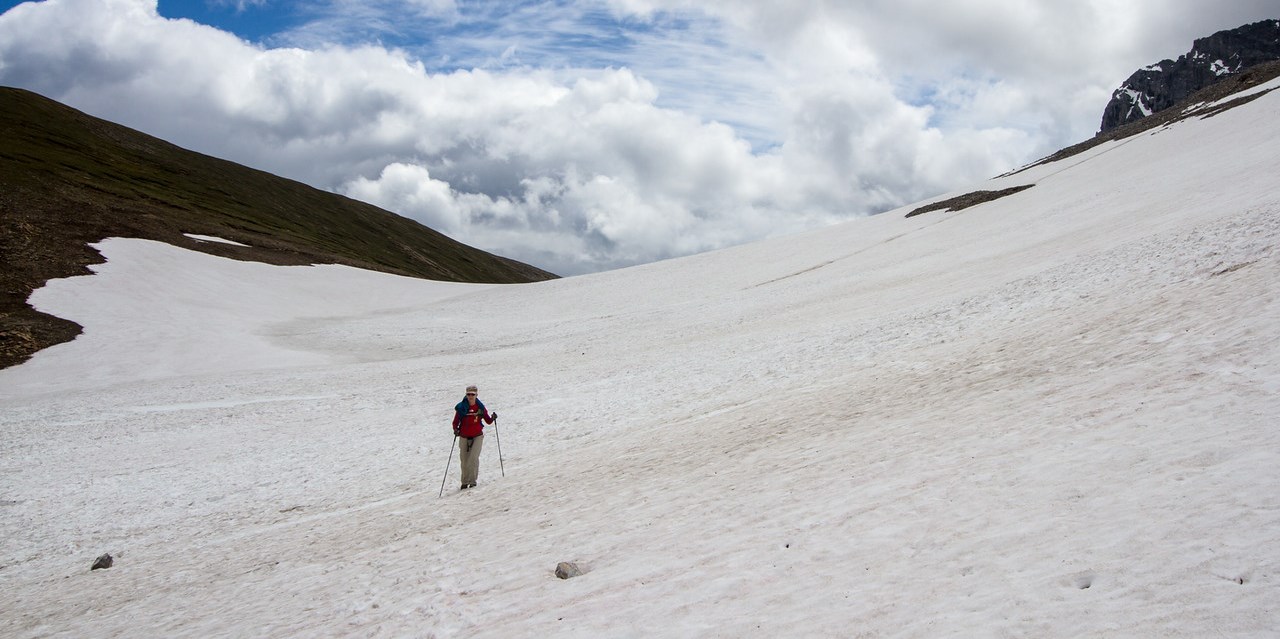
Back up and over the huge snow patches *trudge trudge trudge*

I even let the boy have the camera to get a photo of us.

Wandering across to North Buller pass is a route rather than a path. We spread out and picked our way across the tussocky grass, before reaching… what’s this? Yet more snow!

Thankfully it was fairly easy to cross, although slower than we were expecting. We picked our line carefully, and then made the final steep pitch up to the pass proper.

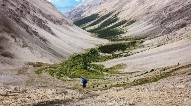
From there we were slightly relieved to confirm that from here down it was going to be mostly just dirt and scree.

We started singing as we picked our way down, and re-entered the trees. Moving faster now, and it was starting to get warmer, and with clearer skies than there had been all weekend.

And below is where I finally confirm that the boy has inherited my weird hyper-flexing joints. Sorry Finn. He really enjoyed being the source of the waterfall though, so there’s that.

And then out out out through the wildflowers again, joining back onto the main trail that connects to South Buller Pass.

Distance: 12km
Elevation gain: 430m

Categories
canada general trip reports

Passes, lakes and flood damage

This one wasn’t my idea, but instead Lincoln came to me and said: “I have a cunning plan”. The plan was to run Rummel Pass, to Guinn’s Pass, to North Buller Pass. Possibly with a side trip to a summit thrown in.

Heading up towards Rummel Lake was the typical Rockies start – get out of the car and start heading straight uphill. The lake came and went without much fanfare, and then eventually we topped out on the first pass of the day.

It was quite windy – we probably weren’t going to be hitting any summits today. Dropping down the other side of Rummel Pass, we wandered towards Lost Lake without a path, hitting undergrowth and bashing about and getting wet before finally emerging at the lake. We had found it, hurrah!

From Lost Lake on, there was actually a trail. A trail that was absolutely covered in deadfall, but at least a sort of trail. Still, the going was a little slow, and we were looking forward to hitting the main trail.

And then we hit the main trail – oh, that’s right, flood damage. We followed along the tagged future trail up towards Lillian and Galatea Lakes, together with exciting creek crossings. Over well placed trees. It’s always amazing to see how much damage the flooding did out here. The amount of water and the forces involved are just mindboggling.

From there, it was up towards Guinn’s Pass. The trail was also a little flood affected, but not too badly.

From Guinn’s Pass, we thought about heading up Mt. Kidd South, but decided we didn’t want to be blown off the ridge. Another day.

It took no time at all to drop down from Guinn’s Pass and wander across to North Buller Pass.

There was more flood damage just below North Buller Pass, with huge swathes of ground just becoming saturated and giving way.

And after admiring the view from North Buller, we made the final run back down towards the road. And then there was the 5km jog back to the car.

Distance: 30km
Elevation gain: 1750m