Categories
canada general moosling trip reports

Canoe camping on Maligne Lake

We paddled a canoe! Me, infamously not a fan of going into water, was convinced to go canoe camping. The boy had never been in a canoe before, and it was the first anniversary of our Canadian citizenship ceremony, so it seemed like a good idea to say yes when we were invited along on the trip.

We were invited along by another couple who’d booked out the whole Hidden Cove camping area – which is really just four tent pads on an island that really isn’t that much of an island, but you can technically paddle around it as long as you’re really careful, and maybe don’t mind hopping out and pushing a little.

We’d been an an overnight kayaking trip before in the Yukon. We’d been in a canoe before. We’d been on a lot of whitewater kayak daytrips, and rafting daytrips. But never an overnight canoe trip. Thanks to borrowed gear, we largely managed to get ourselves kitted out.

Canoe – CHECK (that leaks a little… CHECK)
Paddles – CHECK
Drybags – CHECK
Fishing rod and tackle – CHECK!

And so we lashed everything onto the canoe somewhere or another, and set off across Maligne Lake, following Sean and Jessie with their two kids. Thankfully, the boy thought it was great, particularly when we had any bow waves to cross and the canoe started bouncing up and down. Thankfully I found this all to be wildly tame in comparison to that one time Alex took me out in a double kayak off the coast of Australia at Wilson’s Prom, straight out into the Bass Strait towards Tasmania, in enormous waves that were trying to kill us. On that occasion the swell was big enough that we were constantly losing sight of the other kayaks once we’d paddled away from the shore, and although we managed to paddle out through the breakers on our first attempt, it wasn’t without having my deck collapsed in by crashing waves, and having the bilge pump running continuously as the kayak filled up with water. Anyway, compared to that, this tiny little flat lake seemed fairly innocuous, even with the occasional waves and a bit of wind.

My paddling isn’t great, but we managed to not get left too far behind, and basically headed straight towards the island – it’s only about a 3km paddle to get there.

Pulling up on the dock, we were blown away by the wind – it’s a windy little island! We got a fire roaring in the shelter (which we were very thankful for) and set up tents in the two furthest (and most sheltered) camp sites.

First up was some kid entertainment, in the form of a treasure hunt (and a bug hunt, and another treasure hunt, and some foam rockets).

After dinner, Alex headed out fishing. And caught a fish! After careful study of the fish brochure, we determined that it was a brook trout and we were allowed to eat it.

Seeing as we’d already eaten dinner, Alex prepped it so we could eat breakfast fish the next morning.

And so,  to bed.

We cooked the fish in the stove in the shelter the next morning. (Relatively) fresh breakfast fish is delicious and I would eat it every day. I’ve never had such a tasty fish in my life.

The next day we went for a lunchtime paddle to the next picnic ground further south down the lake. A really short paddle, but something different – and a new fishing spot for Alex, who by this point in time had become addicted. Fishing is just gambling for food, and he had won big right off the bat.

One great thing about canoe trips is that you can justify lugging along luxury items … like silly inflatable sofa devices that are perfect for napping on (if you can just convince the offspring to stop jumping on you for a few minutes).

Back at our home dock, Alex kept fishing. In the rain.

We went wandering around the island with the kids.

And digging in the mud and the rocks unearthed some cool bugs.

That evening we all (with the addition of a few more adult-sized people to our group) sat playing Catchphrase, Cards Against Humanity, Chase the Ace, and engaging in low level pyromania.

The next morning the boy tried some fishing. He’d been overjoyed at the capture of the first fish, but then wasn’t interested in eating it. But was still keen on the idea of trying to catch some more.

And then it started to snow – three of our group set off into the snow and wind, hoping for the best.

The two families stayed behind, waiting out the snow and hoping the weather would break. The warming hut on the island is fantastic (even if the table seems larger than it really needs to be).

And then, finally, there was a patch of blue sky, the wind died down, and we went for it, paddling northward slowly, and stopping in along the shore, fishing a little, exploring a little, and snacking a little.

Alex’s last ditch efforts to catch another fish failed. So we obviously caught and ate the only fish in the lake.

All in all, an awesome trip, and now we’re forming cunning plans to do some more canoe trips next summer.

And maybe even return to Hidden Cove for some winter camping. It’s a long drive up to Jasper, but it would be a perfect snow camping spot with kids.

Categories
bikes canada general trip reports

Hurt’n Albert’n 550

It was 5.40 am and only just light when we arrived in the Cross Iron Mills carpark for the start of the inaugural Hurt’n Albert’n. The carpark already had a cluster of riders gathered in it, and I got my bike together with a whole two minutes to spare. Group photos, hugs and goodbyes, then we headed off for a neutral rolling start along the pavement at 6.05 am. I was mostly in a sleepy daze at this point. There were lots of awesome looking bikepacking folks riding around me. I didn’t know any of them, felt like it would be good to get to know them, but was too tired to make it happen.

We rolled along easily, and I ended up chatting to Jackie and Jeff. Jeff’s fat bike tires were at 30psi. Jackie also hadn’t ridden any of the roads before, but like me had tried to Google Streetview a little to get some idea what they were like.

And then it was gravel time. Ryan, Chris W, Justin and Adam peeled off in front, I sat behind them but didn’t try to keep up. Soon enough I couldn’t see anyone. The guys had disappeared off in front, and the rest of the pack had disappeared behind. Mist hung around, everything was covered in dew, and the shadows were long.

Having to navigate kept things interesting early on. Some of the route choices seemed weird when I looked at the map beforehand, but once I was riding I didn’t care, because having to constantly watch what I was doing kept me occupied.

I didn’t really have a plan, other than trying to ride the whole thing as fast as I could, without hurting myself. I figured I’d keep stops short, and I probably wouldn’t sleep for long – but I’d brought along my bivy and mat, and was definitely thinking I’d use them. Never having ridden any of the roads before, and not knowing what the winds would be like, it was hard to have any idea how long this thing would take me.

There were so many birds in the early section; I saw a few hawks, I think a falcon too, and lots of water birds. I wished my friend Miles was there, he’d know what all these birds were. I spotted crops of canola, wheat, clover, and maybe barley and oats, and felt guilty for not knowing what everything was. I was a terrible farmgirl, I should remember these things. Then there were sunflowers growing alongside the road! And a John Deere tractor that looked alarmingly like a spider, or a creature from a post-apocalyptic future where robots ruled the world and kept humans firmly indentured in slavery. Whatever, in my day tractors looked like tractors.

I rolled through Rockyford without stopping – I didn’t need anything yet. But I waved at a man sitting on his porch with his yappy dog.

The roads varied. Sometimes hardpack clay, great for riding (as long as they’re dry). Others were covered in rocks – gravel I guess, but big gravel that you had to pick a line through. Sometimes, especially later on, there were smaller roads with ‘impassable when wet’ type signs, with huge wheel ruts and quagmires of standing mud.

(Disclaimer: All the road photos I have, I was riding one-handed, so they were only taken when I had a fairly friendly road that was pretty flat. May not be indicative of the rest of the route)

The route started to enter into the Badlands, which were beautiful, and not bad at all. It was almost a shock to hit the area near Wayne and Rosedale. Suddenly there were cars on the road again! I’d gone hours without having a single car drive past me, and suddenly they were all over the place. I stopped in Rosedale to fill up my water, and grab a chocolate milk and Sea Salt Caramel Haagen Dazs (the best icecream ever). I chugged my chocolate milk then hit the road, eating my icecream with one hand. The inevitable happened and I lost a chunk of the chocolate shell on my icecream. Woe!

SCENE: Megan cycles along the road, riding her bike and eating an icecream. She is happy. CLOSE UP of the icecream as the last piece of chocolate shell on it slowly slides off. SLOW MOTION shot from ground level as we see the chocolate land and bounce on the road before settling, as Megan rides away. CUT TO Megan as she glances down at her icecream to eat some more. She double takes and realisation finally dawns as she throws her face towards the heavens and screams “NOOOOOO!”

The main thing of note that happened between Rosedale and Drumheller was my stomach turned bad. Angry and bloated, it wouldn’t let me ride in the drops, and I had to make a couple of emergency roadside stops. I blamed the salami wrap I had brought from home. It had been kind of warm and didn’t feel good to eat. I told my legs that they had no excuse to slow down just because my stomach wasn’t feeling great, and tried to keep my pace up. There was a light wind from the south, and I muttered a little when I had to ride into it without being able to drop into my aero bars.

But it didn’t take too much longer to get to Drumheller. Suddenly I was on the Hwy 9, and the descent on smooth asphalt was fast and easy kilometres. It’s a bit of a shock to re-enter civilisation after hours of peace and quiet and no-one but cows to talk to. (SIDE NOTE – Speaking of cows, there are an awful lot of red Angus in Alberta. Australia has far more black Angus) I rode past the splash park in Drumheller and was looking at it wistfully (oh so nice and cool, looks fun, would be nice to get wet, but also wet shoes and pants are not great and can lead to chaffing, but ah, it looks nice and cool) when I noticed my family there waving at me. I slowed down and waved back, and we yelled hellos. I headed on to the Husky. I’d thought about riding off route to Tim Horton’s, but decided I could manage on service station food.

I ditched the rest of the salami wraps I had with me – I no longer trusted them. My stomach was still angry, and I grabbed a freezie, a green smoothie drink, a protein drink, 1.5L cold water, a sandwich, and a little bag of M&Ms. I got the nice service station people to cut the top of my freezie, shoved the smoothie drink in my back pocket, and stored everything else away. It was pretty warm at this point, and I knew there was a climb up ahead. With my water bottles all topped up with lovely ice cold water, I drank as much as I could then tipped the rest of the bottle over my head and neck – glorious!

I set off eating my freezie. It was also glorious. Alex and Finn had parked by the side of the road just a little further ahead on the route, and they cheered me on and we said our final goodbyes. I kept riding.

At this point, I didn’t really have much idea what was going on, as the phone I was using wasn’t that great – the battery dies quickly and it has really poor reception. So when I tried to check trackleaders in town it just wouldn’t load, so I gave in and stopped trying. I knew the four guys were in front of me as I was headed into Drumheller, but I had no idea that I’d gotten ahead of them with my quick stop.

So I was kind of surprised when two guys came racing up to me as I headed up the hill out of town. And it was only after chatting to them as they rode by that I realised that I had been the lead, and I was now in third place. Huh. Having them to chase in the distance made the long west-ward road towards Beiseker a little more interesting. Uphill, downhill, uphill, downhill. Looking back I couldn’t see anyone. Looking ahead I could see the guys, sometimes close, sometimes further. Sometimes silhouetted on the top of a hill. I put some music on and churned out the kilometres. My stomach gradually started to feel better, so I stopped to eat half a sandwich. Hmm, maybe not that much better. Riding past a farmhouse, a woman came out to cheer with a drink in hand. The rampant enthusiasm in her cheering suggested that maybe it wasn’t her first drink of the evening.

When I rolled into Beiseker Centex the guys were having another sit-down meal (don’t they know it’s a race? :P) and waved me over. So after going for a quick shop in the store I went and chatted to them, found out they were Chris and Adam. Chris was having back issues, and probably going to rest. They let me know that Justin and Jackie had scratched, so had a few others. And sure enough, Justin and Terri showed up at the Centex. I washed the bugs off my arm (I looked like the hood of a car – thankfully they weren’t biting me before dying in my sunscreen). I decided to grab some more food (including the nanaimo bar that was the perfect breakfast the next morning), chatted a bit, then headed off to chase after Adam.

The lead switched back and forth as we rode west, chatting occasionally, but mostly riding on our own. Adam stopped a few times to chat to his legions of fans. He put on his lights, and then I put mine on. Then I stopped to add some more layers. And then at one point I just started to pull ahead. There were some fantastic muddy sections between Beiseker and Water Valley, and I was thankful for good lights as I tried to negotiate them in the dark. This section was largely a long west run, and it was glorious as the stars came out overhead, the gibbous moon hung in the sky to the south, and the lightning of a huge storm cell flashed away in the sky to the north. Spectacular sheet lightning and fork lightning were amazing to watch, but far enough away that I couldn’t hear the thunder.

(Night photo stolen from @flixlee on Instagram)

Far enough away that is, until we hit the edge of the storm cell (I was ahead at this point, but I think Adam was still pretty close behind, I remember seeing his lights… although later on, I’m pretty sure I was hallucinating seeing them). The calm and peaceful night was suddenly filled with a ferocious north wind blasting through the trees. Leaves and twigs were flying everywhere, and I leaned my bike into the crosswind. Then the route turned north, and I was riding into a headwind. The lightning looked a little closer, but I still couldn’t hear any thunder – it was definitely good incentive to pick up my pace a little, I figured the storm was unlikely to be moving westward, so all I had to do was get far enough west and it would go away.

Which actually worked out. Well, at least the wind eventually died down, and I was back to the calm, still night. Nothing was happening, barely a breeze, and my world was reduced to the patch of road in front of me. Sometimes I’d turn my headlight on, and just outside of Water Valley I saw my very first skunk – scampering along the side of the road (and thankfully not going anywhere near me).

In Water Valley I’d decided I just wanted to get in a couple of micro-naps. I’d gotten so far that it seemed pointless to try and get a proper sleep. So after refilling my bottles at the church, I just put on all my clothes, set a 20-minute timer and curled up on the ground for a nap. When it went off I got up, had some more food, then another 20-minute nap. And after that, I felt much more awake, and good to keep going – also quite cold, so that was a good motivation to move on. It was 3.38am and I felt as rested as I had done after our 5 hours of fitful sleep on the Kootenay Gravel Grinder.
I was shivering violently for the first 10 minutes or so after leaving Water Valley, but gradually warmed up. I didn’t see Adam at all, but looking at Trackleaders after the fact, it looks like he rolled into town while I was having my second nap. I was moving slowly, but still moving. I wasn’t feeling super tired, but definitely not very alert and strong either. Because we were on gravel I could tell by the lack of tire marks that there was no-one ahead of me, but I had no idea how far behind Adam was, or if anyone else was coming up from behind. So, it was a slow climb in the dark, into the Waiparous area. I’d look behind me occasionally to check that it was downhill that way, and I wasn’t just being particularly feeble. There were more and more trees around me – I’d never been in this area before, and it was hard to tell what it looked like. I assumed any bears would see my lights, and so wouldn’t try and eat me, I was too tired to bother with bear yells.

As I was glancing back to confirm I was going uphill, I finally started to notice some pink on the horizon. Dawn! Hurrah! I got to turn my lights off somewhere near the high point of the route, at about 450km. My vague route notes suggested it was mostly downhill from here, at least for a while. They lied, and I cursed pre-race Megan. There was another climb almost straight after the descent. “It’s ok” I told myself “I love climbing”.

I’d made a note that there was supposed to be water in the Waiparous campground. The first pump I found was rusted away, but the second seemed ok. I pumped and pumped it, but gave up after 20 or so pumps. Maybe it would work eventually, but I was feeling incredibly self-conscious about being a noisy jerk next to all the people asleep in their tents (at least, they probably had been asleep until some random bikepacker rocked up and tried to get the water pump to work). I still had 1.5L or so of water after filling up in Water Valley. It should be fine.

I wondered if Adam had overtaken me while I was messing around with water pumps. I tried to read the gravel roads – nope, don’t think I can see his tracks. There was some fast sealed road as I cruised into Waiparous Village, and had a rest stop – sunscreen, chamois balm, food, and seeing if my phone had any cell reception (nope). The main part of my breakfast was half a nanaimo bar. It was wonderful, and I finally felt energised again. I hadn’t been eating much sugar so far, so the blood sugar kick was pretty effective. I settled down into my drops and tried to churn out the kilometres.

I was doing ok until I hit the hill of doom. It starts at around 495km, and it’s probably no worse than other hills on the route (or is it?), but covered with gravel, few good lines, and on tired legs, it seemed unnecessarily evil. Plus I kept looking behind me to see if Adam was coming. “For sure,” I thought, “he’ll be able to see me stuck on the side of this hill from miles away.” The descent was equally gravelly and slightly hair-raising, but I was too tired to bother braking much, which was probably a good thing.

After that, there were a series of rolling gravel hills, and I tried my phone again. Service! I sent a message to Alex requesting a beer, and a burrito the size of my head, at the finish line. And then I realised he’d sent me a message telling me my Spot had stopped working. “But I’m checking it regularly, it’s probably ok now… I wonder why it isn’t getting a signal?”

But when I checked it, I found it had been off for hours – I’d forgotten to check it, and the problem wasn’t lack of signal, it was flat batteries. I quickly tried to swap to my spare batteries. Still wouldn’t turn on. Gah. Tried my spare USB battery pack. It wouldn’t power it either! “Maybe it’s broken?”

I was a little sad – I had a great crew of folks watching from home and cheering me on, and I know how much fun it isn’t when someone’s Spot goes dead (also potentially anxiety-inducing). Oh well, not much I could do about it now, I may as well just finish the race. Adam was probably going to catch me while I was wasting time messing around.

I could smell the finish line now and was determined to get there as quickly as possible. I pushed as hard as I could up every hill, because when you’re silhouetted on the top of those things you’re visible from kilometres back, and I knew if Adam caught sight of me he’d try and chase me down. But whenever I looked back I could never see him. My legs felt good, and I finished my Nanaimo bar then rationed out a Snickers over the last hour. I was pushing along easily, counting down the kilometres. And then I was at the finish. And I lay down in the grass and drank a beer and ate my burrito, and hung out and waited to cheer Adam over the finish line. And everything was fantastic, and life was good.

Thanks to Justin and Trevor for putting together such an awesome route, and a great event. It was super fun, and I really enjoyed it – highly recommended, go race it next year! Just remember to get a Nanaimo bar at the Beiseker Centex!

Categories
canada general hiking moosling trip reports

Stanley Mitchell hut trip

Another weekend, another hut trip – it must be summer in the Canadian Rockies.

This time around we were heading out to spend two nights in the Stanley Mitchell hut. In the carpark we decided to hike in via the Iceline – the weather was so nice, and who knows what the next couple of days would bring. Plus there was the added advantage of getting the uphill over and done with first thing. At least that was the theory.

We had three small hikers hiking in with us, and a fourth so small that she was carried the whole way in.

The boys did a pretty great job of hiking in up the enormous hill. Occasionally they argued or complained, but they also did cute things like hiking along holding hands and chatting.

It wasn’t too long before we were up high enough to be getting views of Takakkaw Falls.

And then, stopping for lunch, goofing around taking photos in front of Takakkaw Falls.

I got the boys to work on their jumping – they’ll be experts in no time.

We kept thinking we were nearly out of the trees, and nearly done climbing. But the climbing kept coming and coming. Hmmm. With the way the Iceline trail rolls up and down, you really can’t guarantee you’re done with climbing until you’re back down in the trees again.

More switchbacks brought us higher and higher, until we finally reached the moraine bench (and views of the Scott Duncan hut).

Then we could see glaciers up above us – aha, finally, now it feels like we’re really on the Iceline!

There were some magnificent enormous boulders strewn around. Good for both shady snack stops, and for climbing on top of and ambushing approaching hikers.

There were as many streams to cross as I remembered too. Fresh meltwater, nice and cool on a warm day.

It was a ridiculously gorgeous day too.

We found a patch of snow along the trail at one point, and the boys gleefully took the opportunity to build snowmen, and pelt parents with snowballs.

Then, finally, the descent off the far end. A few switchbacks, and we were back into the trees, hallooing for bears and racing to the hut.

And into the hut! We met up with the others in our group, and had the first of a series of delicious group meals.

Most of the beds were in the loft – and the ladder access was alternately fun and terrifying for the kids.

My contribution to dinner on the first night – chocolate cake with chocolate buttercream icing. The cake turned into a chocolate loaf and muffins, due to baking tin restrictions at the hut. Who am I to complain though, there were baking tins and an oven at the hut!

The stars came out, eventually. Views from the hut were pretty lovely.

And then, breakfast time!

But after breakfast, the first of many play sessions in the Little Yoho River.

Our home for two nights – Stanley Mitchell Hut. The inscription above the fireplace reads ‘sic itur ad astra’ – the latin, ‘thus one goes to the stars’ or something similar.

The boys spent some time playing two-person guitar.

And then hanging out on the island.

Games of bocce were made even more interesting by all the ground squirrel holes around. Sometimes spotters were deployed, other times the players just chose to live dangerously, which led to a couple of reaches into holes to retrieve balls. None were lost over the course of the night.

Alex, Kat and Gavin went for a run in the rain, up to Kiwetiknok Pass.

Then I played an enemy, and had rocks thrown into the river to splash at me by the hoards on the far side of the river. Rivers and rocks – they have endless entertainment value, you just cannot go astray if you camp near rocks and rivers.

And then, it was Sunday morning, and we all started to hike away. But first! A photo of the whole crew.

On our way out, we stopped for snacks at the bridge (or lunch, maybe it was lunch) and Alex napped, as per usual. The Little Yoho River was getting bigger and bigger.

Then, after a lot of downhill, we made it to Laughing Falls. There was a unicorn there.

The boys played a game of ‘hide the rock, and then make the adults find the rock that you hid’. Rocks and rivers, I’m telling you.

Then comes the unfortunate part of the hike, where it’s kind of flat and in the trees. Some people probably love it, but it’s the part of the whole loop that I find hardest to love.  Fortunately the jelly bean and smarties fairies were both visiting, and so the boys had treasure hunting to keep them entertained.

But then finally, we could see Takakkaw Falls. And we’d made it!

Hiking in (via the Iceline):  12km (800m elevation gain)
Hiking out (via Laughing Falls): 11km (~40m elevation gain)

Categories
bikes canada general trip reports

The Kootenay Gravel Grinder

It was 6.50am on Saturday morning, and Alex and I were at the 7-Eleven in Fernie grabbing a spare pair of lithium batteries for the Spot Tracker. I had no idea how old the batteries in the Spot were, and I was about to go and line up to … race? take part in? ride? the Kootenay Gravel Grinder.

Race details had been kind of sparse, and organisation levels minimal. There was originally a 7 am Grand Depart from the clock tower in Cochrane but then it turned out the Cochrane riders wanted to leave on Friday, so they decided to start then instead. So someone else decided to leave Fernie on Friday as well. And I decided to join the small crew who were planning to have a Petit Depart on Saturday at 7 am in Fernie, rather than joining the guy who was leaving Fernie at 6 am, or the guy who still left Cochrane at 7 am on the day of the original Grand Depart. There were maybe eight to ten of us out there riding at approximately the same time, and everything was as clear as mud.

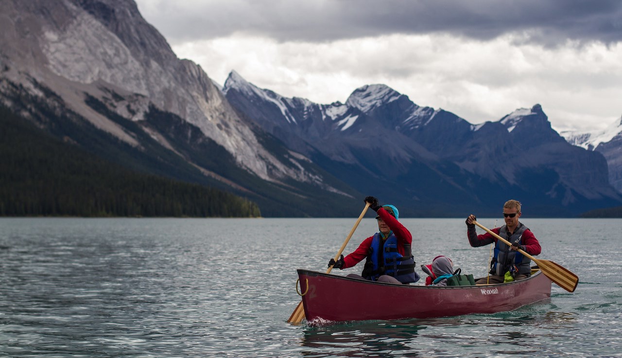
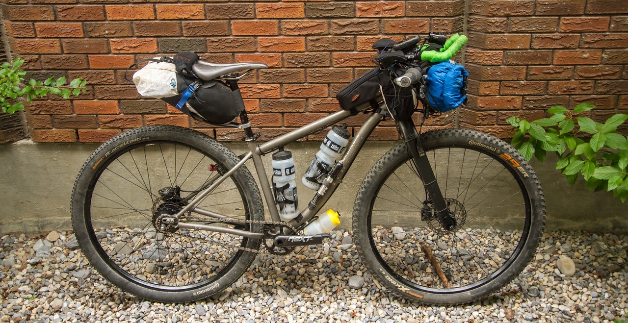
All I knew for sure was that I wanted to be at the Fernie Aquatic Centre at 7 am, and I’d like to have my Spot tracker working because I might be riding on my own in the wilds of British Columbia for a couple of days. When I got to the Aquatic Centre three other bikepackers awaited. Two knew each other, the third was on his own. And so Alex took our pre-race photo, and we set off. And then started to get to know each other.

Amy and Tony lived in Bozeman, Montana. Amy spent her summers in Antarctica at the McMurdo station, and this was her second bike-packing race, after doing the Idaho Smoke and Fire previously. Tony was studying snow science engineering of some sort. And Chip was a hydrologist from Spokane, WA, who had raced the Tour Divide northbound, and toured it southbound, among many other bike races and tours – he rounded out our group.

We all settled into a pretty similar speed. We were just being sociable at first, and I felt like my legs had more to give, but the pace was comfortable and it seemed like a good idea to conserve energy for now. This would be my biggest effort ever if I pulled it off. It turned out we all had similar time goals – to finish within two days. And it was great fun socialising and getting to know other bikepackers.

We stopped for lunch on a bridge and chatted to a friendly couple with bikes, who had a cabin nearby. Well, mostly Amy chatted to them. This was to become a theme of the trip. Amy is excellent at chatting.

As I lay my bike down on the bridge, I eyed the big gaps between the bridge boards and pondered how easy it would be for something to fall into those gaps, and that I should be careful. At which point my Nuun tablets fell out of my seat bag and rolled into the river. Damn.

We’d gone up and over one pass to hit the Corbin mine road, then up and over Flathead Pass, which also seemed fairly non-eventful. Well, the descent was rocky, but what flows like a river in June when the Tour Dividers ride through was fairly manageable in July. I crashed just once, and that was because I was busy staring at the mountains instead of looking where I was going.

Cabin Pass was a fun climb which brought us to Butts Cabin. Notorious among Tour Divide riders, it always used to be the goal for the big hitters on Day One. These days the course has changed, and most of the big hitters ride straight past. It was still fascinating to see in person a cabin I’d read so much about.

Butts Cabin was also where we lost Tony for good. He had been falling further and further behind, and here he told us he was going to just keep going at his own pace. We assuaged our guilt with a promise that we’d buy him a Pepsi at the Grasmere store and stash it behind the store for him – with the assumption that we’d make it there by the 9 pm closing time, and he wouldn’t.

And so now we were three. Next up was The Wall, an infamous connector created so the Great Divide Mountain Bike Route could be directed through the Canadian Flathead instead of taking the more boring and direct road route from Fernie to Roosville. I’d heard so much about it, it was great fun to actually experience in person (and it’s not THAT steep, despite what some folks say).

As we pedalled up Galton Pass it started to rain. Light at first, then heavy rain. This isn’t what the weather forecast said! It was all lies! I mentally shook my fist at the heavens and hoped that the rain would at least be short-lived. I had gambled on the forecast and brought only my super light wind jacket. I was saturated by the time the rain eventually let up. Wet gloves, wet feet, muddy backs. Oh well, it was warm at least.

There was a good little climb to the top of Galton, but not wildly hard (not as steep as Sulphur Mountain, and not too rocky). It was nice to have Chip along, with his route knowledge, and his generally calm, reassuring presence – and interesting to hear his thoughts on how our ride through the Flathead compares to the rest of the Tour Divide route.

Then we were at the top of the pass, still happily pedalling together. We briefly snacked, were attacked by mosquitos, descended. Amy fastest with her suspension, me just behind, and Chip a little further back, but not by much.

We were out of the Flathead without having seen a single bear! Although we’d given them plenty of warning of our presence, so any sensible bear would have easily cleared out of the way.

At the bottom of the pass, we put on our lights and rode into the dusk along the highway. The Grasmere store was closed. But with fast rolling sealed roads and easy gravel, we made it to Kikomun Creek Provincial Park campground around midnight and found a spot to settle in until dawn. We decided to set alarms for 5 am, and then set up in our bivies.

I was testing my theory about it being warm enough to not use a sleeping bag – while simultaneously testing my new bivy, an Outdoor Research Helium. It was not warm enough. I slept a little, then woke up, cold. I put on all the clothes I could find and wrapped a bag around my feet. That helped a little, and I dozed lightly for a few hours. The tones of my alarm at 5 am came as a relief – I was cold and happy to get moving, quickly packing up and getting my things together. Chip was doing the same, and although Amy may have preferred to have some quality snooze button time, she too started to emerge into the dawn. Even though we started to get things together fairly quickly, it was still 5.30 am before we started pedalling.

It was easy riding at first, as we dropped down to Lake Kookanusa and marvelled at the sunrise. We climbed on easy gravel, then flew downhill on more smooth easy gravel into Cranbrook. I pulled ahead a little, but then waited. Having company was more fun, and this scarcely felt like a race. There didn’t seem to be any point in deliberately trying to drop my companions, who were proving to be great fun to ride with.

We took photos at the Cranbrook clock tower, then I dragged them to Tim Horton’s, where we flabbergasted the people behind the counter with the vast amounts of food we consumed and purchased to take with us. One more convenience store stop to stock up a little more, and I found myself a salty caramel Haagen Daasz to eat as we rolled out of town and into the wilderness.

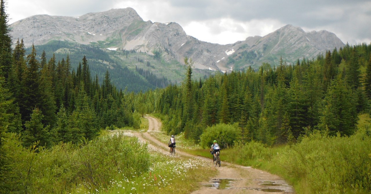
Out of Cochrane, we rode on half-built rail trail and random farm roads, and I learnt a hard lesson about taking one-handed photos with a cell phone. I was fine, but my phone landed on the road and completely refused to turn on again. Argh!

In Fort Steele we stopped for the others to do one more definitely final resupply, as I sat in the shade of a tree, completely failing to convince my phone to turn on.

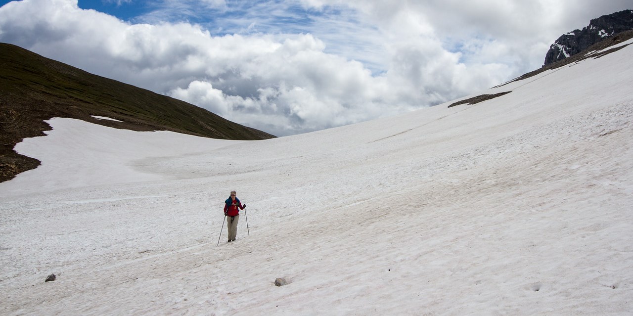
Then uphill, on gravel. Then the gravel turned into rocks, and the day got hotter and hotter, and the sun beat down, and I started to worry about just how much trail we had ahead of us, and was there any way we could make it? Was I going to die of heat stroke? Would my water run out? My legs felt strong, but my behind was not feeling happy. It hurt to sit. Eventually, my poor swollen sit bones went numb, which was at least an improvement.

I stood and pedalled, I sat and pedalled. I rode away from the others, but then stopped at waterfalls along the way to douse myself in water. A man driving a truck stopped to chat to me, then passed on the news to Amy and Chip that I was dripping with sweat. I was not dripping with sweat, I was dripping with freshly killed waterfall!

I felt lonely out on my own, and decided to stop and eat some of my Tim Horton’s panini. Not from hunger so much as a suspicion that I needed the calories. By now my tongue was feeling sore and abraded from eating too many bars, and too much rough and sugary food. I longed for soft, simple food, and wished I had another Tim Horton’s sausage biscuit. Or five. And then Amy and Chip appeared. I leapt to my feet and cheered them! I had once more been toying with the idea of breaking away and finishing alone but realised I was enjoying riding with them too much, and there was nothing to really gain by heading out alone – sure, I might finish sooner, but I would lose the shared experience.

And so we climbed. The end of that pass is a hike-a-bike. Rough, steep. But then the descent begins. First on ATV trails – oh so much fun. Then onto a wide open road that got more wide and open, and we passed the Top of the World Provincial Park and from there it was simple coasting. Almost effortless, except for the need to pay attention and avoid the darned potholes. I slipped into my biggest gear, dropped to the aerobars and churned. Amy was close behind me, stopping to take photos then catching up again. Chip was further back, struggling, and going through a rough patch.

We stopped at the bottom of the road, at a river, then regrouped before moving on to Lussier River to refill our water bottles and cool off a little. Then there was a slight climb into Whiteswan Provincial Park. It was gorgeously easy riding, so smooth. Riding next to the lake was lovely and cool, the breeze was wonderful. It was starting to get later too, and the lower sun helped.

Then we turned off and started to climb. A gorgeous winding forestry road that climbs up above the river, looking down to a beautiful valley, stunning peaks everywhere. I was enjoying the cooler air and easy terrain, although it was here that Amy started her ‘accidental’ attempts to nobble the only other female competition and knock me down the hill at the side of the road. This was a cut throat competition, and there could only be one winner!

And then descent, and we finally started to go south, towards Fernie. But it was getting late, and there was a long way to go.

Moving on, I tried not to think about it the distance ahead, but started the mental countdown once we had 100km to go. One by one I checked them off. Tried not to think about it. Accidentally checked the number on my GPS. It hadn’t changed in minutes. Doomed, we won’t get there forever! The rough road we were on was climbing steeply, what’s going on? My half-hearted route research beforehand had given me only the vaguest idea of the elevation profile up ahead, and what I could remember didn’t seem to match what was happening. Gradual but persistent climbing, and rough, so rough. Sitting hurts. Standing is hard work. Washouts, piles of avalanche debris, flood damage of all sorts. We climb. Streams to cross. We get wet feet pedalling through them.

We stopped for dinner near sunset, and supplemented our bars and food with delicious, perfectly ripe wild raspberries. The valley was amazing and beautiful, and felt so terribly remote, despite being so near civilisation. We hadn’t seen anyone since Whiteswan, and that seemed a long time ago. We could be lost here forever as the world ends.

We put our lights on, as the sky finally darkened. We yelled for bears as we start flying downhill on a rough gravel road. Well, Amy and I yelled for bears. We informed Chip that his cries are too feeble, so we would protect him with our fierce Amazonian bear yells. He didn’t have bear spray either, saying he’d never had any trouble. Neither have I, but I feel compelled to carry bear spray, just in case. Either way, we didn’t see a bear for the entire ride. I think we were making so much noise between us all that any bears would have heard us from miles away.

Frogs were a different matter. All over the road, they hopped and walked, all sizes of frogs. We tried to dodge them. Along with the potholes. Amy got a moth down her shirt, and for a moment we were all laughing hysterically in the darkness as she tried to get it out.

After climbing for so many hours, we got to descend for hours. As it got later and later there was talk of stopping and setting up camp for the night. I advocated for continuing – I’d rather just get to Fernie and then sleep, rather than having another cold night’s sleep here. I guess my cold bivy setup might be good in some ways, it certainly encouraged me to keep moving. The others gave in, and we rode on together.

Finally we were into logging terrain. The road got smoother and smoother, wider and wider. Less claustrophobic and overgrown. And then we turned off our road and started climbing up the final pass into Fernie, towards Hartley Lake. Both Amy and Chip’s GPSs were registering more kilometres ridden than mine, and so Amy had been optimistic we were nearly there. But we were not nearly there. We had the final pass to climb over, but we were only 30km from Fernie now! But 30km is a long way when it’s after midnight, you’ve been riding since 5.30 am, and you’ve already ridden 230 kilometres of rough road that day.

We rode on. The pass was not so bad. Climb, descend, it rolled up and down, taunting us. The last few kilometres to the pass were brutal and steep, but because they were the last, it seemed ok. We were all so tired that we wavered all over the road, sleep drunk and unable to keep a straight line. And then we were at the top. Was this really the top? Yes. Warm layers on. And we descended, concentrating fiercely. Onto pavement. Rear lights on. Down low and hammering on the flat, on this easy sealed road. Fast, fast.

As we made our way through town drunk people wearing crazy hats yelled at us. Where is our welcoming committee, our legion of fans? There is no-one. Just us. We arrived at the Fernie Leisure Centre once again, and took a finish line photo. It was 2.33am on Monday morning. 43.5 hours since we began. Or 1 day and 19.5 hours.

And thanks to Amy and Chip for all the photos. We’ve ordered some parts to try and see if we can get my phone turn back on and try and retrieve my photos, but nothing is guaranteed, they may be lost forever.

Oh, and you can read Chip’s lovely story telling of the ride here.

Categories
canada general hiking moosling trip reports

Out from Ribbon Lake via North Buller Pass

After saying goodbye to the others, we set off towards North Buller Pass.

First, back over the bridge and up along that strip of snow that angles into the creek – none of us fell in.

Back up and over the huge snow patches *trudge trudge trudge*

I even let the boy have the camera to get a photo of us.

Wandering across to North Buller pass is a route rather than a path. We spread out and picked our way across the tussocky grass, before reaching… what’s this? Yet more snow!

Thankfully it was fairly easy to cross, although slower than we were expecting. We picked our line carefully, and then made the final steep pitch up to the pass proper.

From there we were slightly relieved to confirm that from here down it was going to be mostly just dirt and scree.

We started singing as we picked our way down, and re-entered the trees. Moving faster now, and it was starting to get warmer, and with clearer skies than there had been all weekend.

And below is where I finally confirm that the boy has inherited my weird hyper-flexing joints. Sorry Finn. He really enjoyed being the source of the waterfall though, so there’s that.

And then out out out through the wildflowers again, joining back onto the main trail that connects to South Buller Pass.

Distance: 12km
Elevation gain: 430m