Categories
canada general trip reports

Passes, lakes and flood damage

This one wasn’t my idea, but instead Lincoln came to me and said: “I have a cunning plan”. The plan was to run Rummel Pass, to Guinn’s Pass, to North Buller Pass. Possibly with a side trip to a summit thrown in.

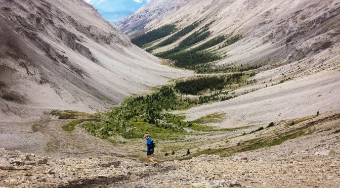
Heading up towards Rummel Lake was the typical Rockies start – get out of the car and start heading straight uphill. The lake came and went without much fanfare, and then eventually we topped out on the first pass of the day.

It was quite windy – we probably weren’t going to be hitting any summits today. Dropping down the other side of Rummel Pass, we wandered towards Lost Lake without a path, hitting undergrowth and bashing about and getting wet before finally emerging at the lake. We had found it, hurrah!

From Lost Lake on, there was actually a trail. A trail that was absolutely covered in deadfall, but at least a sort of trail. Still, the going was a little slow, and we were looking forward to hitting the main trail.

And then we hit the main trail – oh, that’s right, flood damage. We followed along the tagged future trail up towards Lillian and Galatea Lakes, together with exciting creek crossings. Over well placed trees. It’s always amazing to see how much damage the flooding did out here. The amount of water and the forces involved are just mindboggling.

From there, it was up towards Guinn’s Pass. The trail was also a little flood affected, but not too badly.

From Guinn’s Pass, we thought about heading up Mt. Kidd South, but decided we didn’t want to be blown off the ridge. Another day.

It took no time at all to drop down from Guinn’s Pass and wander across to North Buller Pass.

There was more flood damage just below North Buller Pass, with huge swathes of ground just becoming saturated and giving way.

And after admiring the view from North Buller, we made the final run back down towards the road. And then there was the 5km jog back to the car.

Distance: 30km
Elevation gain: 1750m

Categories
bikes canada general moosling trip reports

Bikepacking Jumpingpound Ridge

With a couple of sunny days at our disposal, a new set of bike bags for Alex finally complete, it seemed about time for an overnight bike adventure.

We’d been hoping to do a big loop from home and out into K-Country, via the Elbow loop. It’s still in poor shape following the floods though, so instead we opted for good old Jumpingpound Ridge, where the camping is free and the views can’t be beaten.

The road is still closed to cars, hurrah, and so we had a quiet ride out, much like last time.

This time we were riding early enough to hit wildflower season though, which was nice.

Once we hit the trailhead for our path up to the summit though, the flowers disappeared and the boy was kicked out of his trailer to walk up. Some genius had placed geocaches every 200 – 300 metres along the path. Usually this would annoy me, but on this day, it was perfect bait to lure on a small boy who started to get a little fed up with jumping over roots.

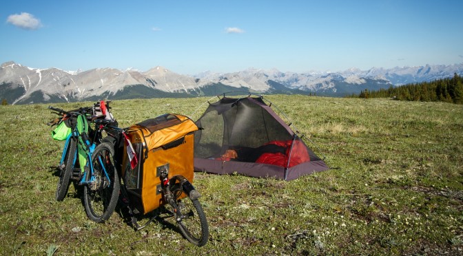
The last push up to the ridge over, we settled in just below the summit to cook dinner in the same spot as last time. Last time it was a bit cold, with a wind picking up that was bringing rain with it. This time it was eerily still, and swarming with mosquitos.

We ran around in circles, slapping and stomping as we enjoyed our dinner and the views. The mosquitos weren’t actually terribly bitey, most of them just hovered in confusion, not sure what to do with the vast expanses of delicious food that had turned up before them. They were a good incentive to get the tent set up though, which we did, piece by piece, in between running around in circles to shake off the clouds of mosquitos (except for Alex, who was for too dignified for such behaviour).

We didn’t bother with the fly on the tent, as the forecast was good, and it was easy to keep an eye on any incoming weather from where we were. We lay in the tent, and eventually switched from mosquito hiding and sky watching, to actual sleep.

A few storms rolled around on the far edge of the horizon overnight. We heard low rumbles of thunder, and watched lightning flashing in the distance. But the sky above us stayed clear, and filled with stars, and the temperature dropped enough to scare the mosquitos away.

The next day dawned wonderfully clear and warm. I watched bits and pieces of the sunrise from the tent, occasionally sticking my head up to acknowledge the different colours banding along the horizon.

As tempting as it would have been to keep lying in the tent, the sun was starting to shine on us with intent, and we had a 3.5 year old in there with us, who is quite insistent that if the sun is up, he should be up.

It was still a lazy and meandering sort of disassembly of camp. There was tea to be drunk, and gear to be thoughtfully rearranged in new bags, as we meditated on the optimal arrangement for the future.

On the descent we found just one surprise drift of snow – not too bad if you’re just out for a day trip, but a small challenge to get around with fully loaded bike and trailer. That was nothing to the next challenge though. As I stopped to photograph Alex coasting down a section of trail, and then off into the distance, put the camera down – and then the singletrailer exploded! The wheel bounced off down the hill in a most poetic fashion. Actually, there wasn’t so much an explosion, as just the wheel coming off and bouncing away. Which did cause Alex to stop pretty quickly.

Here the boy looks despondent as Alex re-seats the bearing into the wheel so it could lock on properly. No rocks were harmed in the making of this photograph.

The final hurdle was the fording of the de-bridged river, which was flowing just a little higher than last year. I tried riding it, and ended up falling in. Which was fine, as I’d been riding in sandals all weekend, due to a forgetting-I-had-flat-pedals-on-my-bike-still incident. After seeing my less than stylish crossing, Alex opted to just walk across as well. I went to throw him my sandals for the attempt, and one fell short, and started floating away downstream. Cold footed lurching and squealing ensued, as I rescued the errant sandal and returned it to Alex.

The rest of the ride passed without incident, and we even made it back in town in time for the Canada Day parade (which was apparently too noisy, so we didn’t stay for the whole thing anyway).

Total trip distance: 33km (Day 1: 18km, Day 2: 15km)
Total elevation gain: 860m (807m of that on Day 1)
More details: We started and finished at the Dawson Recreation/Camping Area, where the Cox Hill trail joins the road. The road is currently closed to public vehicles beyond that point. And we took the trail directly beneath the summit to reach the ridge. Our packing list was much the same as last year, but with no diapers and more spare clothes/underpants for the boy. We did take less water, and now we both have fancy Porcelain Rocket bike bags, everything is much easier to carry.

Categories
canada general hiking moosling trip reports

The Windtower

An afternoon hike up the Windtower…

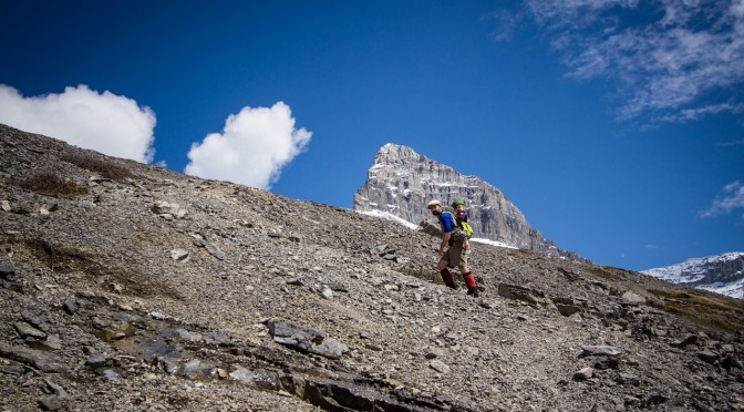
The boy hiked most of the way up to West Wind Pass. And then from the pass, it was onwards and upwards. Below is the view from West Wind Pass up towards the Windtower.

There were a few snow patches on the traverse around.

Family photos with a 3.5 year old.

After a long scree slog – the summit! Which was alarmingly narrow and surrounded by cliffs, and required keeping a good hold on the boy. Alex is looking down at Canmore, visible in the valley behind Wind Ridge.

And views down the Spray Valley as well.

I started trying to train the boy on doing summit jump photos, but he only agreed to try a couple before giving up on the idea.

The boy looks out from the wind shelter on the summit of the Windtower.

Looking over the edge, and trying to convince the boy not to throw rocks.

Descending the scree once again…

Distance: ~10km
Elevation gain: ~950m

Categories
bikes canada general moosling trip reports

Scouting Elk Pass

My next cunning plan was to ride my bike from Canmore to Fernie. But part of this plan involved convincing someone else to come with me, for at least part of the journey. For company, and so the bears would have someone else to eat.

The only difficulty was that the person who seemed most likely to come was being told that Elk Pass was under four metres of snow, and the whole expedition was foolhardy madness. We would be starting our joint journey at the Elk Pass trailhead. Elk Pass is the highest point between Kananaskis Lakes and Elkford, but if it was thoroughly under snow, there could be at least 10km of snow-slogging between us and the rest of the lower altitude (and hopefully dry) trail.

And so I had a scouting mission to undertake. Above is the view from the Elk Pass trailhead five days before we intended to set out. It wasn’t looking terribly promising.

But in the end, it wasn’t actually that bad. There was compacted snow on the trail, thanks to the cross-country grooming that takes place all winter long. But there were also a lot of dry and muddy patches.

The bridge I’m standing on to take a photo of myself? With a foot of snow on it? Five days later it was totally snow free.

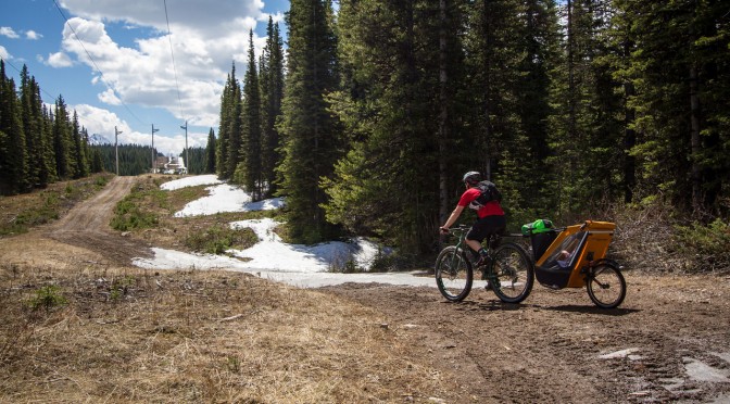
But then, there were a few fairly epic snow patches too. Even towing the singletrailer, Alex fared better than I, with his big fat Krampus tyres.

But then we hit the powerlines, and everything was great! For a while. Then the trail was a perfectly compacted mass of slushy warm snow, mud and puddles of water, so we cycled along through the brush at the side for a while.

Picnic table at the summit of Elk Pass!

I went for a walk, found a good deep puddle of icy water, and tested my new goretex socks in it. Success! They’re absolutely wonderful. Shoes absolutely waterlogged and squelching with icy cold snow melt, feet toasty and warm within. Probably a bit stinky, but who cares so long as they’re warm! My new favourite piece of gear.

The boy spent some time throwing snowballs at everyone and everything, we napped in the sun for a while, and then battled the even mushier snow to descend back down to the car.

Mission successful. It definitely shouldn’t be too hard to get over the pass, the snow was melting like crazy, so things should be even clearer by the end of the week. And starting in the early morning will hopefully mean frozen mud and snow, much easier to ride on.

Categories
canada general moosling snow

Chester Lake

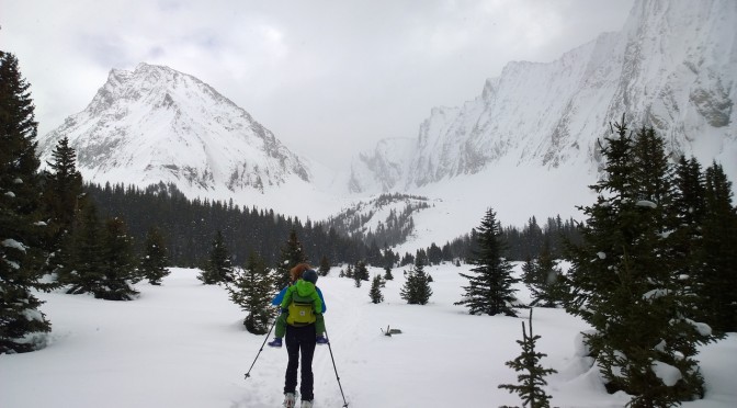
Against my better judgment, we headed over to Chester Lake for some ungroomed skiing – for the first time this winter! The backcountry hasn’t exactly been appealing, so we’ve been sticking to nordic skiing on groomed trails. Sadly everything was a little crusty, and the weather remained pretty overcast, so the old familiar trail wasn’t rendered exciting by awesome weather.

Thanks to the crusty trails, we didn’t get the boy to ski much, but he did manage 600m or so once we were up around the lake. The rest of the time he was hanging out on my back in the Ergo, not getting any lighter.

We even found an excellent hole for our midday luncheon:

It provided no end of amusement, as additional holes were dug, and small people climbed in and out and in and out… and then complained about being hungry because they were so busy climbing in and out of the hole that they’d refused to eat lunch.

An updated version of the “Chester Lake family in a hole” photo was taken too.

Here’s the January 2013 one, for the sake of comparison.

And then nothing remained but to snow plough my thighs into oblivion, down the chopped up, icy trail with an excited wiggly weight on my back.