Categories
bikes canada general hiking snow

Smuts Pass, Birdwood Traverse and Burstall Pass

We planned a grand adventure for the day – from Canmore, then out to Smuts Pass, along the slopes of Birdwood, and over Burstall Pass, then back to Canmore.

First of all to ride along the dusty roads, through biting headwinds, along rough gravel, by many cars.

We attached the magnificent velocipedes to a hidden tree, snacked and tied on some speedy shoes.

Beating through the vicious creek until the valley opened, we began our ascent to Smuts Pass, where the trees finally relinquished their grasp on our flesh.

There we found snow, and trod carefully for fear of getting our shoes dampened.

We looked on the magnificent Mount Smuts and pondered the difficulty of reaching her summit.

Far below lay the Birdwood Lakes, turquoise and marvellous in their alpine splendor.

Then a small traverse, through inches of snow. We thanked the footsteps of those who had travelled before us and made our work easy.

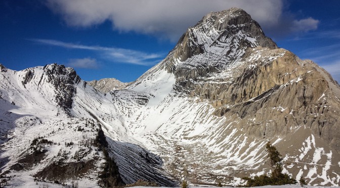
Onwards, and under the mighty slopes of Mount Birdwood, majestic and looming.

We trod carefully as we travelled through yet more snow, our traverse continued.

And then, peering backwards, we admired our footsteps, and the slopes of Birdwood, the marvellous Smuts, and the perhaps less marvellous and certainly oddly named Smutwood.

Then finally Burstall Pass lay before us, with just the slopes of Snow Peak to sidle along before we reached the final pass of our day.

The sidling was long, hard and snowy, but then finally safely over and done. We had reached Burstall Pass and were now on a veritable highway of slush, jogging downhill and back to the flat land below.

From there, the journey to the velocipedes was long, yet not difficult. Except for the large amounts of fatigue in our feet and legs.

As darkness fell we retrieved the velocipedes, attached glowing lights to them, and soared home with a favourable wind at our backs and starry skies overhead. It was glorious.

Distance travelled: 80km (velocipede), 27km (on foot)
Elevation gain: 1130m (velocipede), 1050m (on foot)
Max elevation: 2424m

The foot portion of the day:
Categories
canada general

Grizzly Ultra race report

At 50km, the Grizzly Ultra is barely an ultra-marathon. Which just goes to show how perspectives change – when you’ve started hearing all about other people who are out doing 300km+ trail races, 50km barely seems any sort of distance. Which isn’t the best mind set to fall into.

Despite having the best of intentions when I signed up for this race, I managed to yet again fail to train properly. I definitely got in a lot of long, slow runs, but apparently that wasn’t enough, and I really did need to get in some more shorter runs that actually involved some running.

I was noticing reticence on the downhills even just 15km into the race, and by the time I’d hit 30km, there was no doubt about it. My knees were unhappy, no part of my legs wanted to hammer down hills. Or on the flat really. They were vaguely accepting of hills, but mostly they were trying to convince me I should just go and lie down, and pulling out of the race early wouldn’t be such a bad idea. I told them to shut up, and tried to ignore their whiny complaints. Because there was nothing serious going wrong there, it was just a case of legs going “Waah, we’re tired, this hurts, we don’t like it, we’re hungry, are we there yet?”

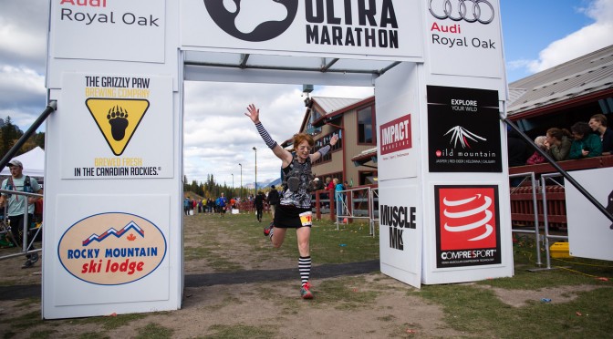
So apart from that, I did actually manage to have fun. The first leg I ran with Lincoln, before he disappeared into the distance like a lanky mountain goat. Then I came across other people to chat to. Or to harass with my terrifying race outfit. Here I am, endeavoring to look as threatening as possible as I leap across the finish line.

After which I sat down for some time.

Distance: About 51.5km
Elevation gain: ~1450m
Time: 5hr32:30 (40 seconds slower than last year, 13 minutes slower than 2012, grrr!)

Categories
canada general hiking trip reports

Tent Ridge, finally!

Another hike we’ve been wanting to do for a while. We considered doing it dressed as pirates (no reason), but in the end went for normal hiking clothes.

It all starts with a lot of slogging up through trees, then up and into the valley surrounded by the horseshoe shaped Tent Ridge.

The boy did a good job of hiking up the hill, with the aid of his mountain climbing stick.

On the top of the ridge (on the east side, we were going clockwise) we stopped for lunch. Then Alex and the boy decided to avoid the scrambly sections ahead, and just head back down again.

Meanwhile, Lincoln and I headed onwards – straight up and over, the classy line.

Spray Lakes sat in the background, bright blue and full of sharks. We reached the enormous fridge on top of the first corner of the horseshoe, and were terribly sad when we found out that it had no icecream or cold drinks, and wasn’t actually a fridge at all. Or if it was, it was quite hard to open.

The views from the ridge really were amazing. Below is The Fist, which was kind of tempting to scramble.

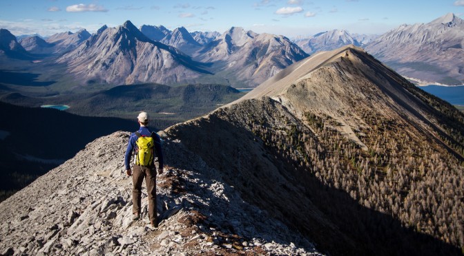
Rounding the end of the horseshoe involved a bit of scree slogging, and then Lincoln peered over the ridge of eternal doom.

Below is the view back across to the east side of the ridge. And some ridiculous mountains and a very blue sky.

Things got quite talus-y for a while there, and then calmed down into an easy gentle ridge again.

We ran into another group of hikers just as we were about to drop down off the end of the ridge, and so there was a mutual exchange of jump shots.

And then the descent. Kind of muddy, with a few crashes, but otherwise successful.

Distance: 11km
Elevation gain: 750m

Categories
bikes canada general moosling trip reports

The annual Skogan pass family epic

Every summer since we grew our small person, we have biked up to Skogan Pass from Canmore. First time was when he was one. And now he is four. So we have done it *counts* FOUR times! (I am a genius)

It’s about a 45km round trip, with a fair bit of climbing. This was the first time he’s come close to participating in moving himself along though – which is good, as he’s starting to get heavy!

On the whole, he’s been spending most of his time on the trail-a-bike dangling with his feet in the air, rather than on the pedals. We came up with a solution for this later in the ride…

With the un-scenic and slightly un-official portion of the ride out of the way, we picked our way around the creek, and started riding uphill.

Enthusiasm and energy levels were a little low today. So thankfully the weather was nice, and there was a lot of food to distract everyone from the fact they were riding up an enormous hill.

About halfway up, the switch was made, and Lincoln started towing the wasp boy (he looks a lot like a wasp, with his legs all dangling down like that.

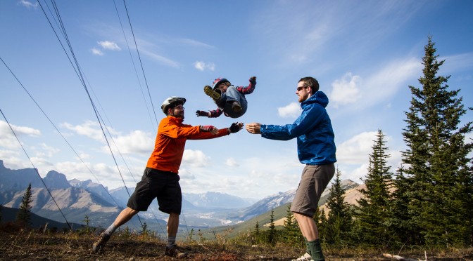
At the summit we ate some more, then had a brief game of child tossing (instigated by the child, who was most upset when we wouldn’t keep doing it). And then a roll all the way back down the hill.

We were part way down the hill when we came up with this brilliant duct-tape themed idea. Because what else do you use to solve the problem of feet that won’t stay on pedals?

After some initial unhappiness with the idea, the boy was fine with it, and he actually (finally!) started pedalling the bike. So, success! (The scrinchy face above is the result of eating a nutbar at a snack stop, not despair over having trapped feet.)

Hopefully next summer we’ll be making the transition to doing all of our bike trips with the trail-a-bike… or _a_ trail-a-bike at any rate, I’m not really sold on the one we have.

Categories
canada general

Run the Wild

My first rogaine in Canada! Well, Run the Wild is more than just a rogaine. Let’s call it an orienteering and rogaining and fun themed race of awesomeness.

We were handed the maps in three stages. First up was a section that was apparently based on an orienteering peg race? With no real orienteering experience, I had no idea what anyone was talking about. But it involved collecting ribbons at checkpoints, and if you were one of the first ten teams to some of the controls, you had to go off and collect an extra checkpoint, and therefore extra ribbons, and therefore end up with more points.

Section two was a trail run of sorts, but with checkpoints along the way, each with one of a series of connected name on them: Rod, Gail and Neil. The trick then was to work out the connection between the names. As an Australian rogainer, it was an easy connection to make from a well known story. All of the Canadian orienteering types were baffled. (They were the three Australians who invented rogaining – the awkward name comes from combining each of their names)

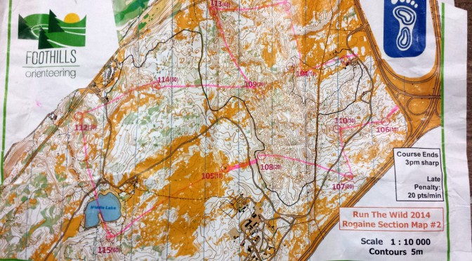
Then onto section three, which was the two map main rogaining part of the course. And we swept the entire course (i.e. collected every single checkpoint!). With 1hr15min to spare in a 6 hour race! This was largely due to Miles and his brilliant navigating – once we settled into the main course, we were bang on arriving at every single control.

There was a brief stop at checkpoint 99 for a “String-O”. Tie yourself to your partner, clip into the string, remove your watches, guess how long it will take you to complete the course. Winner is the team who finishes closest to their guess. Fun, and my counting was pretty bang on, we’d just guessed a time that was too hard to achieve – maneuvering through a field of boulders while attached to someone else is just as difficult as you might think it is.

As we hunted down checkpoints, I was constantly baffled by the fine detail of the maps. I’m used to Australian rogaining maps, where you count yourself lucky to get 1:25,000 or 1:30,000 maps. I couldn’t get the hang of the 1:10,000 map, and just how much detail would be visible with the wacky 5 metre contours an orienteering notations (park bench… fallen tree… boulder… really!?).

Great fun though. And there was port. And delicious post-race food. And swag. And I won a tree! Although I lost my jacket :( So hopefully the tree will be able to protect me from the elements while I’m out running.