At the farm was where everything went rapidly downhill, as I went from being in perfect health, to suddenly being ill and having no voice.


At the farm was where everything went rapidly downhill, as I went from being in perfect health, to suddenly being ill and having no voice.
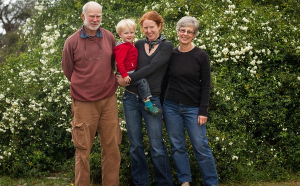
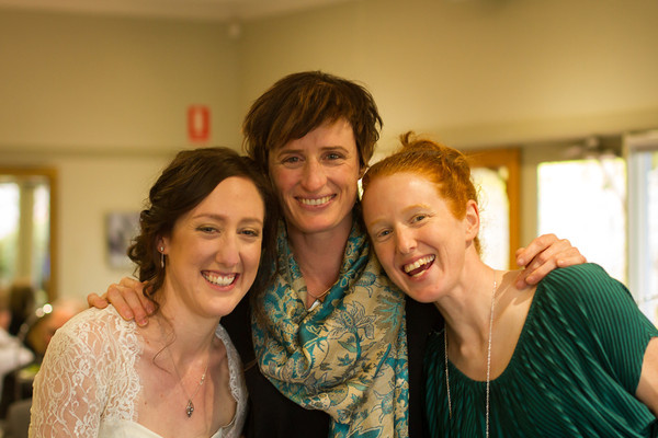
We didn’t mean to go to Canberra. But there were friends there we hadn’t seen since I was 39 weeks pregnant. And now we had a three year old, and they had a two year old. And it only added four or five hours to the drive to my parent’s farm! In the end it turned out to be an absolutely cracking idea, despite all the driving.
The offspring had a ball playing together.


Our friends loaned us bikes, and one of them watched the Moosling, so Alex and I could go off and ride the Mount Stromlo trails with the rest of the group – so much fun! And riding on 26″ MTB wheels again (as opposed to the 29″ wheels on my current bike) was a bit of a revelation.

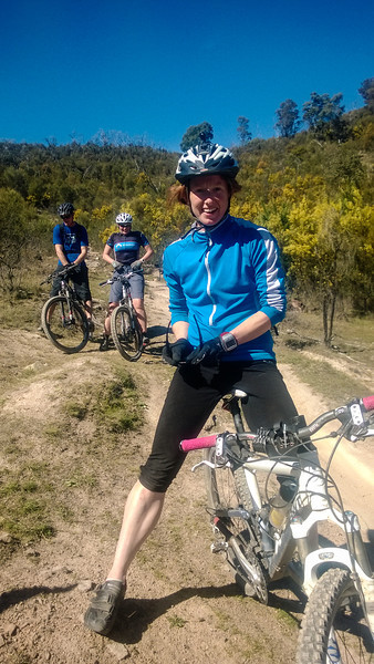

Even the Moosling got to ride at Stromlo…

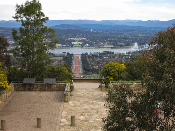
And then I went for a run – up Mount Ainslie, across to Majura and back down again. Canberra, you were much more fun than I expected you to be.


It all began with an aeroplane flight. Well actually, it began with friends telling us they were going to be getting married in September 2013, but giving us nearly two years notice, so we made cunning plans to be around for their wedding. And to make it a huge trip to visit lots of friends and family. But then there was an aeroplane flight.
The weather was perfect, so we sat and stared out the plane window, and confirmed our house wasn’t on fire. Or if it was, at least the whole building wasn’t yet ablaze.
We arrived successfully in Melbourne along with all of our luggage, and went to throw it all into our hire car. This was the last straw for a tired and sick Moosling, who had been looking forward to the prospect of finally getting to the car after all this time on aeroplanes (“No more aeroplane! Aeroplane go down now!”). But it was the wrong car, and entirely the wrong colour (“No blue car!). So he was distraught and cried for ten minutes, but eventually fell fast asleep in the back seat as we drove to our destination.
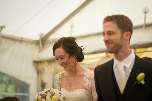
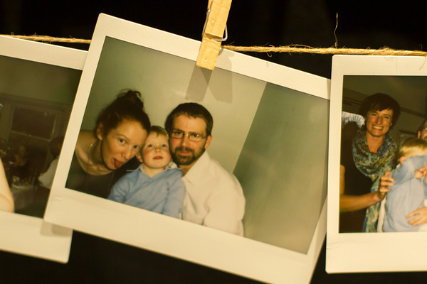
After a couple of days of stunned wandering around, and lots of sleeping, and a couple of Rosh Hashanah dinners, we went to the wedding in Olinda. And it was lovely!
We re-created photos from the old days…
And much fun was had by all. Particularly the Moosling, who realised that he could use his cuteness power for evil. He was crawling about under the tables and popping up onto peoples laps then asking for “chocolick?” and then escaping with their chocolates.
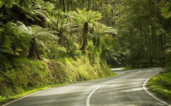
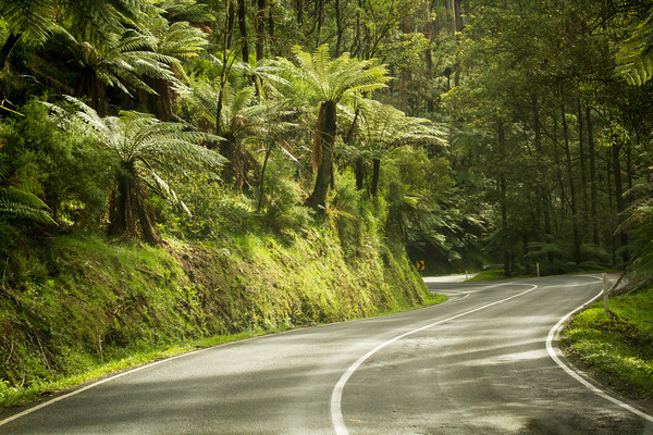
The next day though, we were up and driving to Canberra. Through the Black Spur, and beyond!
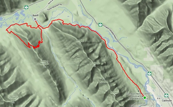
I’d been wanting to do something a little epic on Saturday, but couldn’t decide what. But then I was invited to run along the Rundle Riverside trail from Canmore to Banff. “What a fantastic idea!” I said to myself, “And then if I’m still feeling chipper I could run up and down Sulphur Mountain as well, I’ve been meaning to do that.”

It’s been a while since I’ve ridden it, but I think Rundle Riverside makes a better running trail than biking trail. The Canmore end is horrifically rooty. After a while though, it eases off and becomes a very mellow mossy sort of trail, and it’s a bit disappointing when you’re suddenly spat out onto the golf course roads.
Nineteen kilometres later, and I was still feeling good, so I said goodbye to my running companion and headed out around the slopes of Sulphur to find the trail up the back. Past the Cave and Basin, towards Sundance Canyon, then a sudden left turn uphill, onto an old fire road.

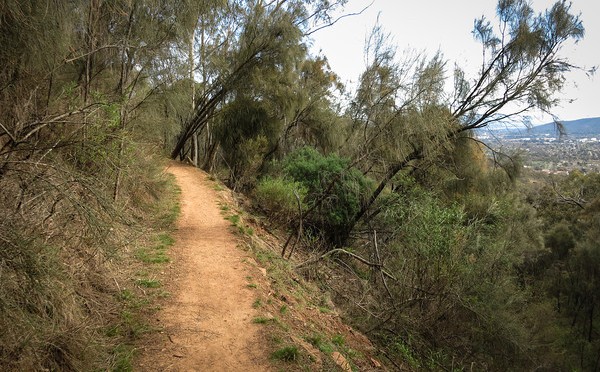
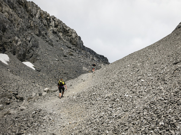
The lower slopes of the back side of Sulphur are a bit un-inspiring. It’s just an overgrown fire road the whole way up, and while you’re down low, there’s not much of a view, just a fire road slog.

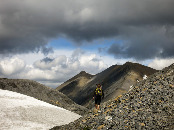
But then the view gets better.

And the trail climbs up into the sky.

Until suddenly you’re at the top! There are tourists everywhere, who took the gondola up, and are complaining about having to climb some boardwalk and stairs to get over to the summit peak itself.
I plunged on down the hill, intent on catching the 3pm bus back to Canmore. After running at a decent clip from the gondola base station to reach the downtown area, I made it with time to spare to go and buy a cold drink. Mission successful!
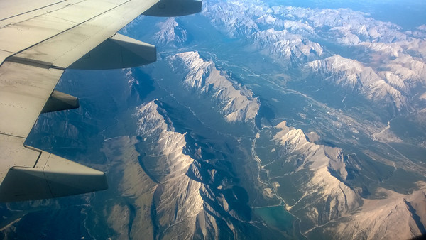
Now I just have to pack my bags to catch a flight to Australia this afternoon, where I’ll be visiting for three weeks.

Distance: 40km
Elevation gain: 1,330m
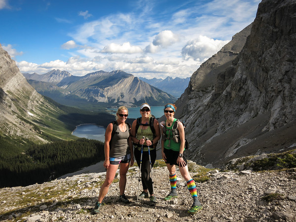
First of all, a taster of what lies ahead:
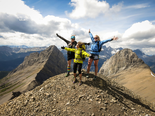
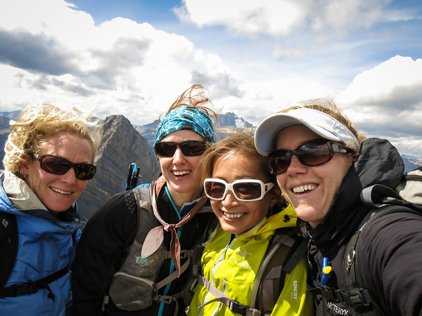
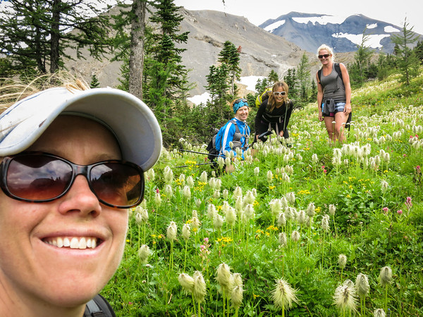
We’d all been talking about running Northover Ridge for a while. The plan had always been to do it in a day, and finally we had chosen the day. Many folks were invited, but in the end it was just the four of us who made it. Debate began about how long it might take us, what gear we should take, and how early we should leave Canmore.
We settled on a 6am departure from Canmore, which crept a little later, and after the one hour drive down to Kananaskis Lakes, and getting gear together, it was 7.50am before we set off. We were parked at the northern carpark at Upper Kananaskis Lake. Part of the southern section of the lake was closed, so the plan was to run out and back via the north shore of Upper Kananaskis Lake.
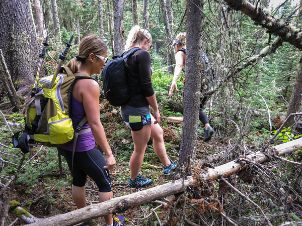
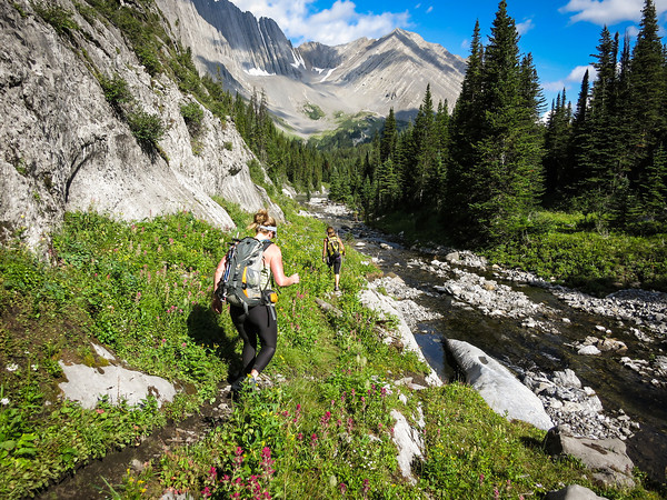
After running for a while, we hit the turn-off to Hidden Lake, and were instantly slowed to a crawl, as we clambered over, under, and through the snarl of fallen trees along the eastern shore of the lake. The trail was easy enough to follow though, just not easy going.
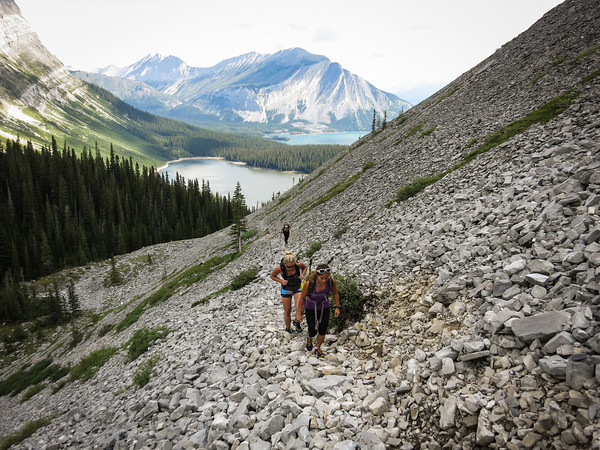
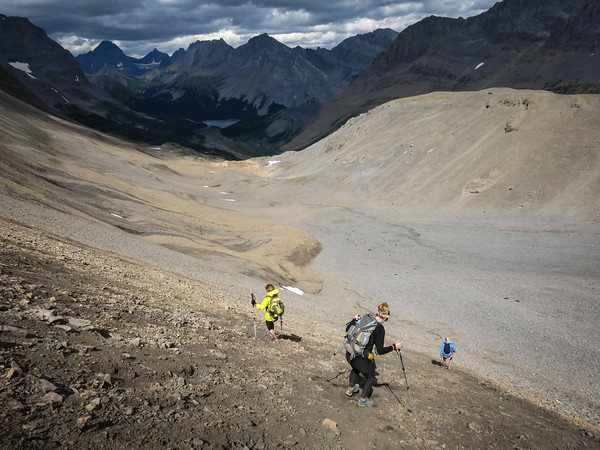
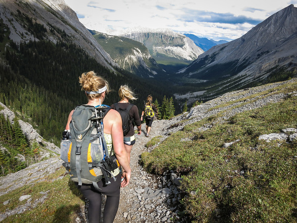
It was up and away once we reached the south of the lake, as the trail climbed steeply through the forest and out onto the open scree slopes of Mount Sarrail.
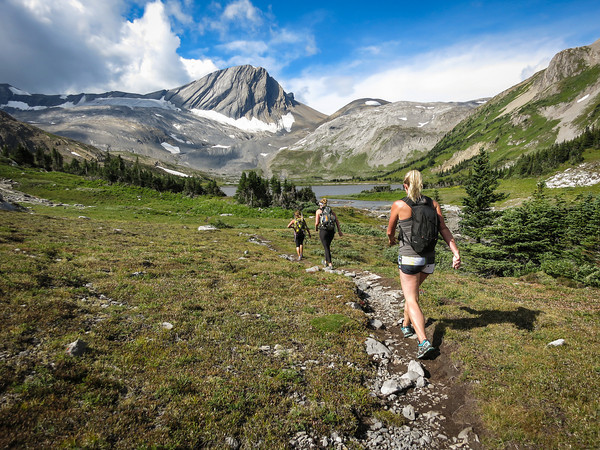
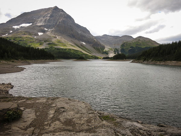
The Kananaskis Lakes shimmered in the distance behind us, and white fluffy clouds made the sky seem even bluer. We met a couple of groups on their way down from the Aster Lake campground, but by and large had the trail to ourselves, as we continued to climb up to Aster Lake.
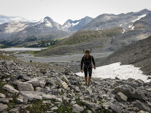
Eventually we popped over an edge and into the Aster Lake basin. Sadly, the lake was not wildly picturesque, but instead a dingy brown colour. I am in the process of drafting a letter of complaint to Parks Canada about the poor state of their lakes.
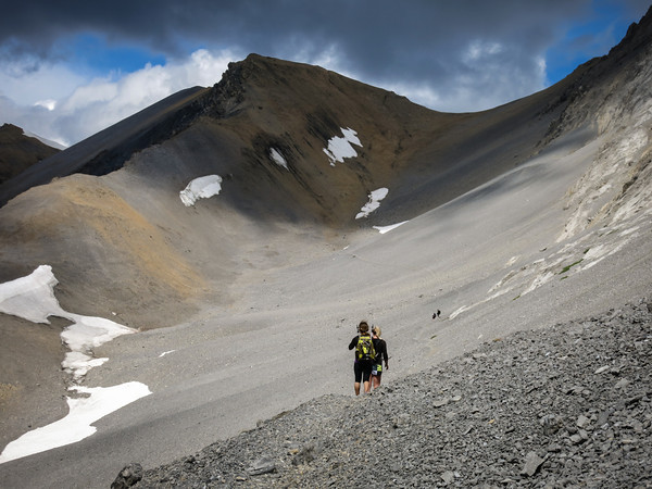
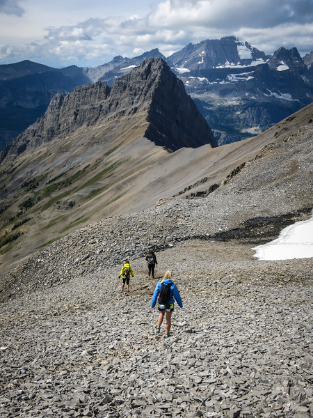
We had a brief snack stop at the lake, but then pushed onwards and upwards, around the south shore of the lake, and up the scree between Warrior Mountain and Mount Northover.
The clouds were getting a little cloudier at this point, and the breeze a little windier.
I marched along with a little trepidation, as I eyed off the clouds and the wind suspiciously, hoping neither would conspire to prevent us from being able to hike the ridge. We wouldn’t be at the half-way point of the day until we were well and truly along the ridge, so I struggled with my internal monologue, trying to find sensible justifications for continuing on no matter what the weather was doing.
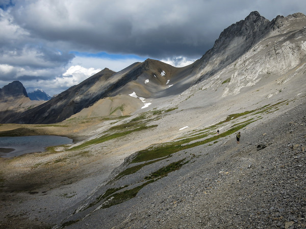
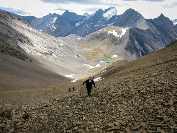
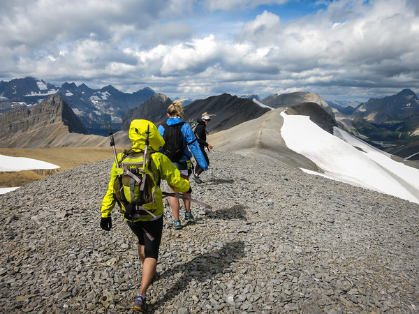
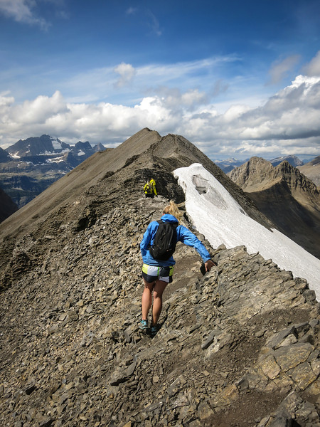
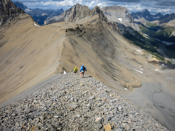
We re-grouped as we drew closer to the scree slope we would climb to gain the ridge. In the photo below you can see a couple of black dots further along the trail – we were to overtake them half way up the scree slope; they were overnight hikers travelling with enormous heavy packs. The path to the top of the ridge lay in the grey slope directly above them, although to get to the path up, you first had to traverse almost all the way to the snow.
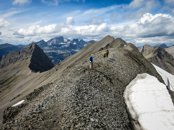
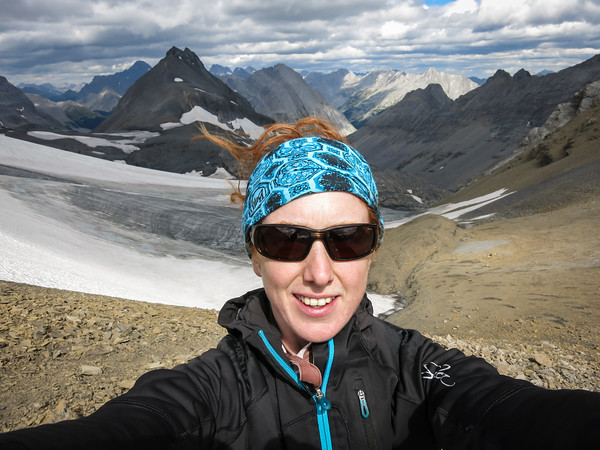
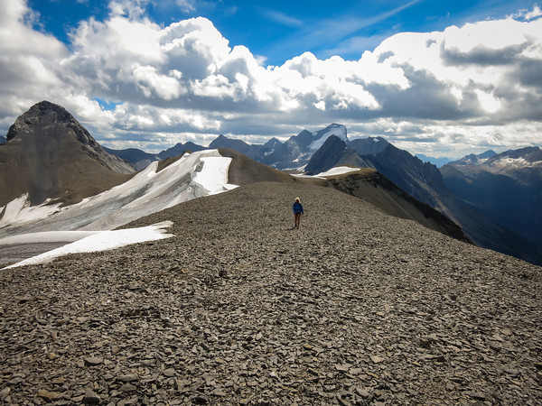
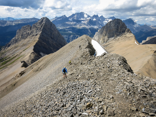
And then we were on the ridge! And it was wonderful! There was even a glacier!
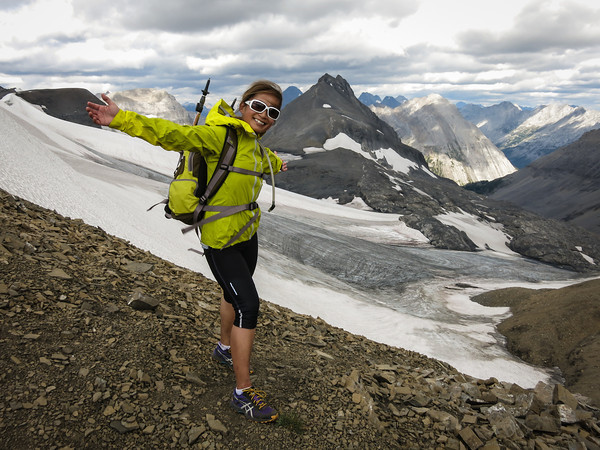
But wonders never cease, as we then got to hike along the ridge for a few more kilometres… it was largely wide enough that we could have easily been running, but we were too busy admiring the views. And trying not to be blown off.
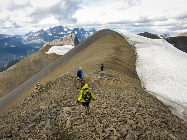
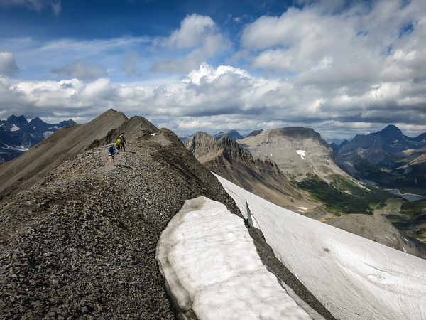
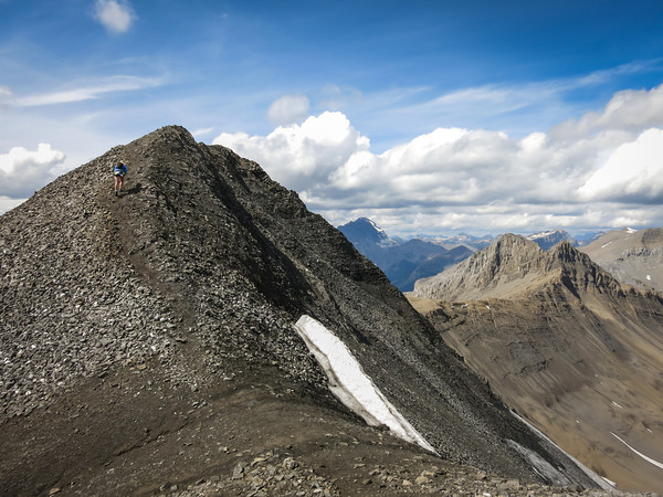
Then, sadly, it was all over. There had only been a couple of narrow points, nothing that was too tricky, although I’d probably not take anyone up there who wasn’t happy with heights and exposure.
And so, we dropped down, and said our final farewells to British Columbia (as the ridge follows the provincial lines).
An awful scree slope took us back down into Alberta. Doing the trail clockwise definitely seems like the best option.
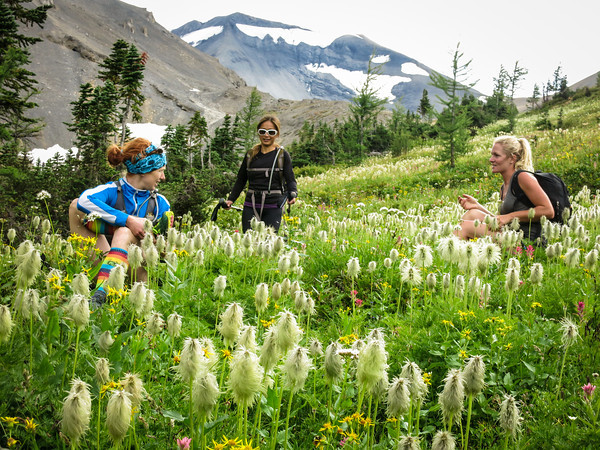
Before we dropped down to Three Isle Lake, we spent some time frolicking in a meadow full of wildflowers.
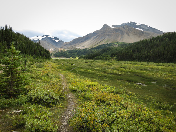
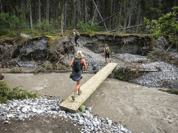
We kept going by Three Isle Lake, and lost a lot more altitude as we followed the trail down by the flood-ravaged Three Isle Creek.
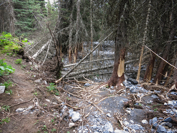
From here on, there were quite a few places where the trail had been re-routed due to flood damage.
But, we started running again!
Although we eventually lost motivation over the last couple of kilometres of rough trail, and settled back into a steady plod. All of a sudden, we were at the car! And there were cupcakes, and stashed food of all sorts.
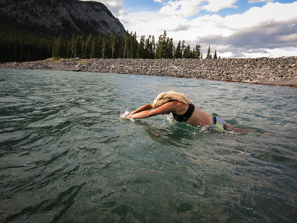
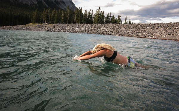
I stood waist-deep in the lake eating my cupcake. Jacket on top, but naught but underpants, socks and sneakers on my bottom half, as I stood in the water, soaking my legs for 10 minutes, to ensure they’d be feeling wonderful again tomorrow (it works wonders!). All were in awe of my trend-setting fashionista ways. Meanwhile, Kim actually jumped in for the full submersion experience.
Overall, highly recommended, five stars, would run again!
Distance: 35km
Elevation gain: 1,610m
Time: About 10 hours