Categories
canada general trail running

The Grizzly50 Ultra

A year ago, the Grizzly 50 was my first ultramarathon, the first time I’d run further than 35km, the first time I’d raced further than 21km. In the intervening year I’d run the Frozen Ass 50 (on sealed trails in Calgary in the middle of winter, a terrible idea), and the Powderface42 (held at the Canmore Nordic Centre due to flood damage around the actual route). I’d been signed up for a couple more 40-50km trail running events, both cancelled due to the floods. But by now the idea of running a long way on trails was no longer slightly terrifying and incomprehensible. It was something I knew I could do. I had lost the fear. I had, perhaps, become a little too relaxed about the whole idea.

So when I spent three weeks in Australia (running a few times, but spending most of my time sitting in a car, on an aeroplane, or just sitting around coughing a lot and feeling dreadful), and then a few more weeks back in Canada (also sitting around a lot, feeling tired, jetlagged, sick again, and unmotivated) not exactly getting the best possible lead up to a 50km trail run, I figured it would still probably be ok.

Surprisingly enough, it kind of was. For the first 25km, I was even on track for a sub 5-hour finish. But then my calves started cramping. I would catch a toe on a root, and a spasm would grip my entire calf, holding my toes en pointe as my calf muscle bulged angrily. I worked hard to keep my toes up, as spasms flickered around my calves and up and down the side of my legs. My right IT band muttered angrily at me, and my knees glared a little. I slowed down, gritted my teeth, and tried to keep my legs under control. I sadly shuffled down fun single track descents that should have had me leaping joyously from root to rock, and cursed myself for my lousy preparation. And I shivered and ran harder as the grey skies darkened, and it snowed a little.

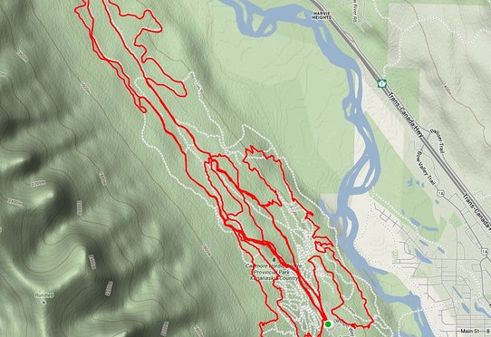
The best part of this race (apart from the fun course), is the fact that it consists of five different loops, of different lengths, covering different terrain, but all looping back to the Nordic Centre daylodge. It makes for wonderful motivation when you have a rotating cheering squad greeting you at the end of each lap (and momentary confusion, as you try and follow the correct course markings for the lap you’re on next – you only need to be able to count from one to five, but that gets quite tricky around lap three or four).

Anyway, the end result was that I finished. Annoyingly in a slightly slower time than last year, but 5.5 hours on the course wasn’t too bad given the lousy lead-up to the day. Will I do it again next year? Undecided for now, but I feel the need to do it properly – so perhaps!

Distance: Rather rudely, the course is 51.2km instead of 50km. Percentage-wise it’s not a huge error, but the final 1.2km passed in a haze of bitter resentment and glaring at my watch.
Elevation gain: 1202m
Time: 5hours 32min

Categories
canada general hiking trail running

The mighty Yamnuska

This was my first time on Yamnuska – it’s one of a few classic local destinations that has been on my list of places to go for a while. I had an afternoon free, and Sarah was keen to come along with the dogs, and so we thought we’d see how far we could go with them.

The answer? Not past the chains, but dogs that are happy to scramble a little can definitely make it that far.

It was a sort-of trail running day. The running was slow and a little unenthusiastic (recovering from illness, jetlag and three weeks at sea level can tend to do that), but we escaped the kraken at any rate.

Distance: 9.2km
Elevation gain: 783m

Categories
canada general trail running

A crazy long run

I’d been wanting to do something a little epic on Saturday, but couldn’t decide what. But then I was invited to run along the Rundle Riverside trail from Canmore to Banff. “What a fantastic idea!” I said to myself, “And then if I’m still feeling chipper I could run up and down Sulphur Mountain as well, I’ve been meaning to do that.”

It’s been a while since I’ve ridden it, but I think Rundle Riverside makes a better running trail than biking trail. The Canmore end is horrifically rooty. After a while though, it eases off and becomes a very mellow mossy sort of trail, and it’s a bit disappointing when you’re suddenly spat out onto the golf course roads.

Nineteen kilometres later, and I was still feeling good, so I said goodbye to my running companion and headed out around the slopes of Sulphur to find the trail up the back. Past the Cave and Basin, towards Sundance Canyon, then a sudden left turn uphill, onto an old fire road.

The lower slopes of the back side of Sulphur are a bit un-inspiring. It’s just an overgrown fire road the whole way up, and while you’re down low, there’s not much of a view, just a fire road slog.

But then the view gets better.

And the trail climbs up into the sky.

Until suddenly you’re at the top! There are tourists everywhere, who took the gondola up, and are complaining about having to climb some boardwalk and stairs to get over to the summit peak itself.

I plunged on down the hill, intent on catching the 3pm bus back to Canmore. After running at a decent clip from the gondola base station to reach the downtown area, I made it with time to spare to go and buy a cold drink. Mission successful!

Now I just have to pack my bags to catch a flight to Australia this afternoon, where I’ll be visiting for three weeks.

Distance: 40km
Elevation gain: 1,330m

Categories
canada general hiking trail running trip reports

The amazing Northover Ridge

First of all, a taster of what lies ahead:

We’d all been talking about running Northover Ridge for a while. The plan had always been to do it in a day, and finally we had chosen the day. Many folks were invited, but in the end it was just the four of us who made it. Debate began about how long it might take us, what gear we should take, and how early we should leave Canmore.

We settled on a 6am departure from Canmore, which crept a little later, and after the one hour drive down to Kananaskis Lakes, and getting gear together, it was 7.50am before we set off. We were parked at the northern carpark at Upper Kananaskis Lake. Part of the southern section of the lake was closed, so the plan was to run out and back via the north shore of Upper Kananaskis Lake.

After running for a while, we hit the turn-off to Hidden Lake, and were instantly slowed to a crawl, as we clambered over, under, and through the snarl of fallen trees along the eastern shore of the lake. The trail was easy enough to follow though, just not easy going.

It was up and away once we reached the south of the lake, as the trail climbed steeply through the forest and out onto the open scree slopes of Mount Sarrail.

The Kananaskis Lakes shimmered in the distance behind us, and white fluffy clouds made the sky seem even bluer. We met a couple of groups on their way down from the Aster Lake campground, but by and large had the trail to ourselves, as we continued to climb up to Aster Lake.

Eventually we popped over an edge and into the Aster Lake basin. Sadly, the lake was not wildly picturesque, but instead a dingy brown colour. I am in the process of drafting a letter of complaint to Parks Canada about the poor state of their lakes.

We had a brief snack stop at the lake, but then pushed onwards and upwards, around the south shore of the lake, and up the scree between Warrior Mountain and Mount Northover.

The clouds were getting a little cloudier at this point, and the breeze a little windier.

I marched along with a little trepidation, as I eyed off the clouds and the wind suspiciously, hoping neither would conspire to prevent us from being able to hike the ridge. We wouldn’t be at the half-way point of the day until we were well and truly along the ridge, so I struggled with my internal monologue, trying to find sensible justifications for continuing on no matter what the weather was doing.

We re-grouped as we drew closer to the scree slope we would climb to gain the ridge. In the photo below you can see a couple of black dots further along the trail – we were to overtake them half way up the scree slope; they were overnight hikers travelling with enormous heavy packs. The path to the top of the ridge lay in the grey slope directly above them, although to get to the path up, you first had to traverse almost all the way to the snow.

Looking back down the scree slope, towards Northover Tarns and Warrior Mountain

And then we were on the ridge! And it was wonderful! There was even a glacier!

But wonders never cease, as we then got to hike along the ridge for a few more kilometres… it was largely wide enough that we could have easily been running, but we were too busy admiring the views. And trying not to be blown off.

Then, sadly, it was all over. There had only been a couple of narrow points, nothing that was too tricky, although I’d probably not take anyone up there who wasn’t happy with heights and exposure.

And so, we dropped down, and said our final farewells to British Columbia (as the ridge follows the provincial lines).

An awful scree slope took us back down into Alberta. Doing the trail clockwise definitely seems like the best option.

Before we dropped down to Three Isle Lake, we spent some time frolicking in a meadow full of wildflowers.

Looking back to our path travelled across the river plain

Three Isle Lake

We kept going by Three Isle Lake, and lost a lot more altitude as we followed the trail down by the flood-ravaged Three Isle Creek.

From here on, there were quite a few places where the trail had been re-routed due to flood damage.

But, we started running again!

Although we eventually lost motivation over the last couple of kilometres of rough trail, and settled back into a steady plod. All of a sudden, we were at the car! And there were cupcakes, and stashed food of all sorts.

I stood waist-deep in the lake eating my cupcake. Jacket on top, but naught but underpants, socks and sneakers on my bottom half, as I stood in the water, soaking my legs for 10 minutes, to ensure they’d be feeling wonderful again tomorrow (it works wonders!). All were in awe of my trend-setting fashionista ways. Meanwhile, Kim actually jumped in for the full submersion experience.

Overall, highly recommended, five stars, would run again!

Distance: 35km
Elevation gain: 1,610m
Time: About 10 hours

Categories
canada general hiking trail running

Running the Iceline

The cunning plan for the day was to go and run the Iceline Trail in Yoho National Park. The added difficulty was having to take it in turns, so we didn’t have to tie the Moosling to a tree with nothing more than a bottle of water, a toasted cheese sandwich, and a can of bear spray to defend himself.

Alex got to run first, heading off at 8.40am from the Takkakaw Falls carpark. He headed straight up onto the Iceline from there. Meanwhile, back at the river we wandered about, threw stones, and checked out the relief map of the area. The Moosling drove stones around on the roads of the map, crashing them down to the ground from the map edge: “Oh no crash! Oh no fall, oh crash!”

11.10am and Alex was back, having taken the shorter loop option; running down past Celeste Lake and back to the car in 17.5km. So then it was my turn.

It had gotten a little warmer and a little busier on the trail by then, so I was overtaking group after group as I marched up the switchbacks then ran along the ever wonderful Iceline trail. The forecast threatened afternoon showers, but so far the clouds didn’t look too threatening, and it was only getting warmer.

I dropped down onto the trail past Celeste Lake too, running past wildflowers, and considerably less people.

But then it was up the switchbacks of doom on the Whaleback Trail. They’re fairly relentless, the sun was baking, flies were hovering about me, sweat was dripping, and there wasn’t another soul on the trail.

But then, joy! The summit! The views! And a slight breeze! It was all worthwhile.

Getting down the back of the whale wasn’t very fast going either, with lots of rocky, rooty trail with overhanging branches. Remnants of the winter snowpack were lingering on Twin Falls Creek though, and the creek itself roared along in a scenically aqua fashion.

I was a little outraged to discover there was yet more uphill ahead, as I had to skirt around before I could descend to the base of Twin Falls.

Then it was back along the Marpole Lake trail – which turned out to be full of scree and talus, and also pretty slow going. A few peeping creatures though, so it wasn’t entirely without merit. From then on I was running back along familiar territory, past Laughing Falls and then along the valley bottom, a section of trail that actually was less painful than I remember it being when we had to coax along a tired toddler at the end of the day.

Finally back at the car and ready for a nice soak in the freezing cold river.

Distance: 25.2km
Elevation gain: 1391m
Time: 3.5 hours