Categories
canada general hiking moosling trip reports

Mount Assiniboine Redux: Day Four

Day Four dawned, another clear day with warm weather. Marvel Lake campground is a little dark and claustrophobic, so I didn’t mind escaping it. The boy was very unimpressed with the fact he had to leave his friend behind though.

He did cheer up a little when he discovered all trail signs had a chocolate button at the top though. You get someone (Lincoln) to lift you up so you can push the button, and then you get chocolate! Hurrah!

The trail widened to double track in to time, and we started working the child entertainment mojo. With some good trail breaks in there to keep everyone happy. It was blissfully cloudy for some time, for which we were all thankful, but still pretty warm.

At one point, the boy discovered that my backpack had a turbo button. Press it, and I had to (reluctantly, and with flailing arms) run for 10 – 15 metres. He took to this with great relish. Everyone else seemed to have some sort of turbo button as well – although they worked with varying degrees of effectiveness.

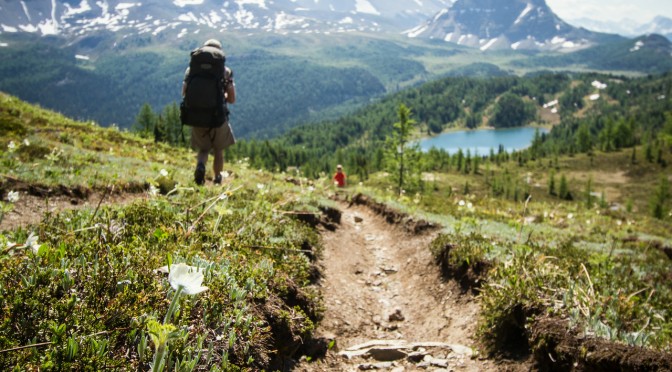
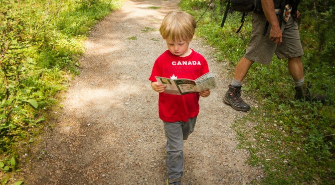
The boy stole a flower flicker and claimed it as his own though, beginning to pore over it with great interest.

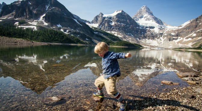
When you’re hiking in this sort of weather, every lake is for swimming. We discovered just how shallow Watridge Lake is though, it’s possible to walk across the entire thing. And there’s so little current that footprints of others remain for some time.

It was at Watridge Lake that we were finally caught by the boy’s friend, and he enthusiastically joined her in identifying flowers for the final walk out to the car park – hurrah!

The final section was, as always, a bit of a slog. And, as always, raised many questions as to why the signage does nothing more than tell you that you’re on a road. We know that we’re on a road! It’s a large straight road! It’s blindingly obvious! What we would quite like to know, is how far it is to the carpark. Or the lake. Or both.

But we did it! And the boy did it! And none of us went mad and strangled any of the others after the three hundredth rendition of the bear hunt song! The weather and views and company were wonderful, even if the mosquitos were not. And although I wouldn’t recommend a 3.5 year old as a hiking partner to anyone planning to cover long distances, I was pretty pleased we managed to cover our 15 kilometres a day. Next time, I won’t underestimate just how much tasty bribery food would be ideal though.

Hiking distance: 14.5km
Distance covered by small child: 14.5km plus additional running to and fro and general gallivanting metres
Flowers species identified: 23
The 2010 version: Here
Categories
canada general hiking moosling trip reports

Mount Assiniboine Redux: Day Three

Alex got up early this morning, and headed out to hike up the Nublet with a couple of others. I bravely guarded our tent from intruders in his absence.

This is the photo you can get if you hike up the Nublet for sunrise though:

We got going in a semi-organised kind of way, although the boy’s enthusiasm wasn’t high first thing in the morning.

He spent plenty of time sitting on the ground and complaining about tired legs for the first kilometre – we weren’t too concerned though, as they promptly got better and were good for running as soon as anything interesting happened.

We ended up taking it pretty easy that morning though. First there was a prolonged break to throw rocks at the majestic scenery.

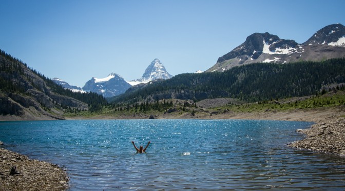
Which turned into wandering around naked in the lake for those of us under the age of five.

That was followed by lots of running along boardwalks, and then watching fish swim up a stream. Alex tried going trout tickling, but failed to catch us one for dinner, despite some fairly amusing fish stalking attempts.

We were amazed by how beautiful the Wonder Pass trail was though, especially in comparison to Assiniboine Pass which we’d hiked over last time. We had gone that way because we thought it was shorter, but I’m not even sure it is shorter! And even if it is, a trail is much easier to hike along if you have wonderful things to stare at.

Speaking of wonderful things to stare at, a helicopter flew overhead at one point. The picture below captures the boy going “Wow! Coool!” as the helicopter went by. His excitement quickly transformed into terror as the helicopter kept flying back and forth, getting closer and closer to us. After that close call, we armed ourselves with sticks, just in case any other helicopters tried to get us.

The awesome scenery continued, as did the slow pace. But we had Lincoln with us this time, which helped keep the small person a little more entertained.

And there were lots of streams and bridges to stop at. Right towards the top of the pass we came across an enormously fat and content marmot. He hopped off one rock, then belly-flopped and wiggled his way onto another, before continuing to lazily sun himself. Marmots seem to have their life priorities sorted.

As we crested Wonder Pass, we found a nice breezy spot with a bit of shade to stop for lunch. Oops, we still had a long way to go, better pick up the pace!

Setting off after lunch, we realised that the others had lunched just a few hundred metres ahead of us. But we quickly lost them as we hiked down towards Marvel Lake.

There were some exciting snow patches to cross, and snow balls to be thrown.

But then the switchbacks began. Back and forth, back and forth, singing the Bear Hunt song again and again and again (“Uh oh, chocolate!… We can’t go round it. We can’t go under it. We’ll have to eat our way through it!”) The day got warmer, and the lake got tantilisingly closer.

Eventually the path stopped descending, and instead traversed along above the lake, taunting us with its glittering blue presence, so close yet so far.

Every stream crossing the trail became an opportunity for a break, and occasionally, for re-filling water containers.

But then we finally caught the others! And their tasty, tasty goldfish crackers.

From then on we hiked mostly as a group until we reached Marvel Lake.

The boy was thrilled to find a friend at this point, in the shape of a very sweet 9 year old girl who was out hiking with her parents. She very patiently listened to him enthuse about trains, and kept pace with him as we walked to the shores of Marvel Lake.

There we stopped to cook dinner, while the new friend kept going. There was much despair for some time, but food heals many issues in life.

Eventually we got up and hiked the final kilometre to the campground, and there was much joy as we set up our tent in the campsite next to the new friend, and went and visited her before going to bed for the night.

Hiking distance: 15.5km
Distance covered by small child: 15.5km plus additional running to and fro and general gallivanting metres
Free cookies: None :(
New friends for the small child: One very sweet nine year old girl from Calgary
The 2010 version: Here

Categories
canada general hiking moosling trip reports

Mount Assiniboine Redux: Day Two

We emerged from our mosquito-proof shelters into the bug-filled utopia outside.

The day started slowly, as we pretended to be freight cars being towed by various different engines. It’s tricky to walk very quickly when on a narrow trail holding hands.

Golden Valley and Valley of the Rocks were as hot and dry as I remembered them, and took just as long, if not longer, than I remembered them taking to walk through.

Breaks were frequent though – to climb on rocks, to steal goldfish, to give mosquitos a tasty, tasty dinner….

Finally though, the valley started to open up. We were no longer under imminent threat of ambush.

And was that? Could it possibly be? It was Lake Og!

The distance is much easier to cover when there’s a nice cool lake in sight. There may have even been a little galloping along the trail so we could hurry up and jump in for a swim.

The water was perfect.

And the breeze by the lake wasn’t too bad either.

After Lake Og the Evilmoose Family were on their own until we reached Assiniboine Lodge. This created some challenges in child motivation, as we’d run through most of the entertainment options we could think of by now.

Necessity is the mother of invention though – or something like that. And so we were trains, and planes, and helicopters, and animals, and we spent much time discussing cakes and birthdays.

There was a stop to climb onto The Rock in the meadow, and then the boy attempted to carry Mama’s pack. “Too heavy!”

This trail keeps seeming like it will be over, and then isn’t. But that’s always more likely to happen when you’re travelling at 2km/hr.

But then we reached Assiniboine Lodge! They had a telescope, and cookies, and cold drinks, and everyone else was there, and we were nearly at the campsite! And Lake Magog was JUST THERE! And Mount Assiniboine was JUST THERE!

The final walk to the campsite wasn’t too bad – it involved a lot of sticks and bridges, and then once we arrived at camp, the two small people went to play in their mosquito-free haven while we all set up camp again.

A few of us headed down to the lake to cook dinner. The boy threw rocks…. and then tried to help filter some water for us. It was a bit tricky for a small boy with small hands. The view from the lake was as gorgeous as ever though, and like last time, we had perfect weather.

Hiking distance: 16km
Distance covered by small child: 16km plus additional running to and fro and general gallivanting metres
Free cookies: One for each of us, courtesy of the lovely people at Assiniboine Lodge who were very impressed by a small boy with big strong legs.
The 2010 version: Here

Categories
canada general hiking trip reports

Mount Assiniboine Redux: Day One

Many moons ago I was 34 weeks pregnant and hiked from Sunshine Meadows through to Mount Assiniboine and out to Mount Shark in three days. It was wonderful, although getting in and out of a tent was challenging, and on the last day my feet were so swollen I had to hike in sandals instead of hiking boots.

This time around we decided to see if we could make it more challenging by taking a 3¾ year old boy with us, and try and convince him to walk the whole way under his own steam. Because he really is getting too heavy to carry.

Fifteen kilometres per day over four days… what could possibly go wrong?

The forecast was for gorgeously sunny warm weather for the next four days. As we started out around 8.30am, it was already terribly pleasant out.

We climbed up the enormous hill from Sunshine Village up to the Meadows (disclaimer – hill not actually enormous, just tends to feel that way). And then spent some time loitering by Rock Isle Lake and waiting for the rest of the group to catch up. Which they did! Before we had been eaten by mosquitos. But that kind of set the tone for the rest of the trip. There are some very well fed mosquitos out along that trail.

Soon after we hit our only patches of snow, just before Lake Howard Douglas. It was the cause for much joy and throwing of snowballs.

And then the descent to the Lake. And look, we’re nearly at Citadel Pass aren’t we?

Getting from Lake Howard Douglas to Citadel Pass at small child pace takes a bit longer than one would expect though. This was another theme for the trip – readjusting expectations so that 2km/hour seemed like a pretty good pace.

Thankfully a dinosaur turned up to chase the small child most of the way to Citadel Pass. It took to hiding behind trees, and in dinosaur holes, and then leaping out at the small child. Yes, this is a valid motivational tactic. Shhh.

Above is a photo of small child hiding from incoming dinosaur, and below a fearful child running for his life as a slightly apathetic dinosaur pursues him.

Finally we made it to the Pass for a late lunch, only arriving a little later than the rest of the group. And there was much lazing around and swigging of champagne to forestall the effects of mountain lassitude. Meanwhile Mount Assiniboine hovered pointily in the background.

The descent to Porcupine Campground starts off beautifully, but then seems to keep going forever and ever until you’re sure you must be dropping into the very bowels of the earth itself in some kind of Verneian nightmare. But then you end up in a nice little busy valley with a freezing cold stream, and quite a few other campers.

It was much quieter last time we stayed here, but that may have been because camping fees were still charged then, these days it’s officially free to camp at Porcupine, which is a pretty nice deal.

So the small child spent time throwing rocks in a stream, and then frolicking in a mesh tent with the even smaller child, while the large people made food, erected tents, collected water and killed tigers.

And eventually they all went to bed, and were mightily relieved that mosquitos are kept at bay by tents.

Hiking distance: 14km
Distance covered by small child: 14km plus additional running to and fro and general gallivanting metres
The 2010 version: Here

Categories
bikes canada general moosling trip reports

Bikepacking Jumpingpound Ridge

With a couple of sunny days at our disposal, a new set of bike bags for Alex finally complete, it seemed about time for an overnight bike adventure.

We’d been hoping to do a big loop from home and out into K-Country, via the Elbow loop. It’s still in poor shape following the floods though, so instead we opted for good old Jumpingpound Ridge, where the camping is free and the views can’t be beaten.

The road is still closed to cars, hurrah, and so we had a quiet ride out, much like last time.

This time we were riding early enough to hit wildflower season though, which was nice.

Once we hit the trailhead for our path up to the summit though, the flowers disappeared and the boy was kicked out of his trailer to walk up. Some genius had placed geocaches every 200 – 300 metres along the path. Usually this would annoy me, but on this day, it was perfect bait to lure on a small boy who started to get a little fed up with jumping over roots.

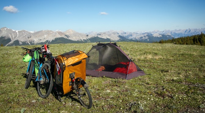
The last push up to the ridge over, we settled in just below the summit to cook dinner in the same spot as last time. Last time it was a bit cold, with a wind picking up that was bringing rain with it. This time it was eerily still, and swarming with mosquitos.

We ran around in circles, slapping and stomping as we enjoyed our dinner and the views. The mosquitos weren’t actually terribly bitey, most of them just hovered in confusion, not sure what to do with the vast expanses of delicious food that had turned up before them. They were a good incentive to get the tent set up though, which we did, piece by piece, in between running around in circles to shake off the clouds of mosquitos (except for Alex, who was for too dignified for such behaviour).

We didn’t bother with the fly on the tent, as the forecast was good, and it was easy to keep an eye on any incoming weather from where we were. We lay in the tent, and eventually switched from mosquito hiding and sky watching, to actual sleep.

A few storms rolled around on the far edge of the horizon overnight. We heard low rumbles of thunder, and watched lightning flashing in the distance. But the sky above us stayed clear, and filled with stars, and the temperature dropped enough to scare the mosquitos away.

The next day dawned wonderfully clear and warm. I watched bits and pieces of the sunrise from the tent, occasionally sticking my head up to acknowledge the different colours banding along the horizon.

As tempting as it would have been to keep lying in the tent, the sun was starting to shine on us with intent, and we had a 3.5 year old in there with us, who is quite insistent that if the sun is up, he should be up.

It was still a lazy and meandering sort of disassembly of camp. There was tea to be drunk, and gear to be thoughtfully rearranged in new bags, as we meditated on the optimal arrangement for the future.

On the descent we found just one surprise drift of snow – not too bad if you’re just out for a day trip, but a small challenge to get around with fully loaded bike and trailer. That was nothing to the next challenge though. As I stopped to photograph Alex coasting down a section of trail, and then off into the distance, put the camera down – and then the singletrailer exploded! The wheel bounced off down the hill in a most poetic fashion. Actually, there wasn’t so much an explosion, as just the wheel coming off and bouncing away. Which did cause Alex to stop pretty quickly.

Here the boy looks despondent as Alex re-seats the bearing into the wheel so it could lock on properly. No rocks were harmed in the making of this photograph.

The final hurdle was the fording of the de-bridged river, which was flowing just a little higher than last year. I tried riding it, and ended up falling in. Which was fine, as I’d been riding in sandals all weekend, due to a forgetting-I-had-flat-pedals-on-my-bike-still incident. After seeing my less than stylish crossing, Alex opted to just walk across as well. I went to throw him my sandals for the attempt, and one fell short, and started floating away downstream. Cold footed lurching and squealing ensued, as I rescued the errant sandal and returned it to Alex.

The rest of the ride passed without incident, and we even made it back in town in time for the Canada Day parade (which was apparently too noisy, so we didn’t stay for the whole thing anyway).

Total trip distance: 33km (Day 1: 18km, Day 2: 15km)
Total elevation gain: 860m (807m of that on Day 1)
More details: We started and finished at the Dawson Recreation/Camping Area, where the Cox Hill trail joins the road. The road is currently closed to public vehicles beyond that point. And we took the trail directly beneath the summit to reach the ridge. Our packing list was much the same as last year, but with no diapers and more spare clothes/underpants for the boy. We did take less water, and now we both have fancy Porcelain Rocket bike bags, everything is much easier to carry.