Categories
canada general hiking trail running

The mighty Yamnuska

This was my first time on Yamnuska – it’s one of a few classic local destinations that has been on my list of places to go for a while. I had an afternoon free, and Sarah was keen to come along with the dogs, and so we thought we’d see how far we could go with them.

The answer? Not past the chains, but dogs that are happy to scramble a little can definitely make it that far.

It was a sort-of trail running day. The running was slow and a little unenthusiastic (recovering from illness, jetlag and three weeks at sea level can tend to do that), but we escaped the kraken at any rate.

Distance: 9.2km
Elevation gain: 783m

Categories
general hiking trail running

The Australia Trip – The Rogaine

It’d been a long, long time since Alex and I had been rogaining. Actually, I just had a look back, and the last time we did one properly on foot was back in May 2002. That was the rogaine that ruined my knees, leaving me barely able to walk for weeks, and in chronic pain for over a year – back in the bad old days before I found a physio who was actually helpful. After that we did a few cycleogaines, paddleogaines and snowgaines together, as well as adventure races. But we never got in another old-style rogaine before we moved to Canada in 2007. Over here there are a lot of orienteering clubs that like to mention rogaining, but precious few events are actually held. (NB. Rogaining is like orienteering – but you have a fixed time limit, from 6 – 24 hours usually, to collect as many checkpoints as possible. Checkpoints are worth different amounts, and so route planning and navigation plays a big role in your success)

Our first rogaine together (and my first rogaine at all) was the first time we had a chance to catch up after we had initially met. In North American terms, it was almost like a first date. But in this case we were on a team of three doing a six hour rogaine, one of a few different teams cobbled together by our university outdoor club (go La Trobe University Mountaineering Club, go!). We bonded over a desire to run up and down hills, and to try and find checkpoints in muddy and inconvenient locations – while the girl we had been grouped with must have bemoaned the companions she’d ended up with, as I think she’d been hoping for more of a gentle hike. We set a trend on that rogaine, and arrived back late, losing 90 points – our companion was unimpressed with our foolhardiness, but we didn’t care, we had cheese toasties to eat at the hash house, and we’d had a ball!

So, once we had our plane flights booked for the Australia trip, one of the first things I did was start looking to see if there might be a rogaine on while we were there. For the first time in over ten years, we might be able to do a rogaine together while we were both in reasonable shape for running long distances. It looked promising, and sounded fun. I kept checking back to the rogaining page, and finally a few details cropped up. Something in Wombat State Forest – a six hour, and a twelve hour perhaps? Unsure about our options for Moosling-sitting, we opted to sign up for the six hour rogaine, and eagerly pored over old maps, trying to remind ourselves how it all worked.

All of this said, I was quite determined to go ahead and do the rogaine, despite the fact that when the day came I was feeling miserably sick. And couldn’t really talk. I could kind of manage a rough whisper, but it was painful. My legs seemed like they might work, I just wasn’t sure if they would continue working for six hours. But not going would have been akin to having made reservations at a wonderful and hard to book restaurant, reservations that you had made months and months ago, and eagerly anticipated. You’d read the menus, and dreamed of what you might eat. It was the restaurant where you had your first date, and where you might not have a chance to eat at again for years – and then just not going. It would have been outrageous.

So, with me dosed up on flu medication, we got ourselves ready early on Saturday morning and hit the road. On our way we found a fantastic little bakery in Bacchus Marsh for breakfast, and for once we arrived early for registration – we had over an hour to plan a route! It was unheard of!

After agreeing on a rough plan of attack, with lots of options for adding or dropping sections (depending on how we were going for time), we nervously eyed off the competition and debated what to wear. Then eventually we herded ourselves into the starting arena, and waited.

The first couple of minutes went quite well. We ran towards the first checkpoint we wanted to find, and struck out confidently through the bush. But it wasn’t there! Had we not gone far enough? We were in the wrong place! We had assumed we were following road X on the map, but in fact we were following a road that wasn’t on the map at all, and were horribly lost (well, perhaps not horribly, but certainly nowhere near our checkpoint). We struck on the plan of walking north – oh look, there are people there who seem to be walking purposefully in the trees…. aha! It’s the checkpoint! Wait, what’s that? It’s a completely different checkpoint? Oh. Well. We’ve wasted the first half hour of a six hour race, but we now know where we are, lets not waste any more time.

From then on things started to go a little more smoothly. The navigation came back to us, and we made a series of suspiciously good decisions. There was less arguing than I was accustomed to, largely because I didn’t have enough of a voice to disagree with anything.

I was running along, simultaneously feeling awful and having a wonderful time. The distraction of constant navigation and decision-making made the hours fly by – and we happily avoided most of the heavy undergrowth and scratchy acacia-type bushes, barring that one awful checkpoint that seemed to be surrounded by the hideous stuff.

After convincing Alex to go south for one more 80 point checkpoint (such a good idea!), we started to head back north, cutting off a chunk of points we’d been hoping to collect on the eastern section. As we zig-zagged from checkpoint to checkpoint, we calculated we should arrive back in the vicinity of the hash house with plenty of time to pick up the two extra checkpoints that were just nearby. Our old age must have rendered us more sensible when it came to calculating time, as we collected both the 70 point (steeply up the hill directly above the hash house, across a small stream that Alex made me jump into), and a 30 point (a few hundred metres downstream from the hash house, along a nicely graded trail), and still arrived back with about five minutes to spare.

Apparently I ran so hard my shoe exploded though! The Saucony Peregrines are great trail shoes, but the upper tends to get a little weak, and seems to get small rips in the fabric. The weakness that already existed in the upper couldn’t withstand a rogaine apparently, and as I was wearing toe socks, I spent half the race running along with my little toe hanging out. The other poor gear choice was wearing my old gaiters, which I had forgotten had failing velcro. I spent most of the race leaning over to try and re-attach them, and prevent them from falling off altogether. If there was any more undergrowth to struggle through, I really couldn’t have gotten away with bare knees either – as it was they were feeling a bit scratched up and awful.

All in all though, it was fantastic fun, and we were wishing we were doing the 12 hour. And we think most of the more competitive people must have been in the 12 hour, as despite my illness, and our early incompetence, we still managed to come second overall in the 6 hour, pretty closely behind first place (covering around 34km in the process). Now we’ve been scouring the Canadian internet for rogaines to do, but sadly cannot find any to feed our rogaining fever. Perhaps we’ll have to kick-start our own rogaining association over here, they don’t know what they’re missing out on.

Categories
canada general trail running

A crazy long run

I’d been wanting to do something a little epic on Saturday, but couldn’t decide what. But then I was invited to run along the Rundle Riverside trail from Canmore to Banff. “What a fantastic idea!” I said to myself, “And then if I’m still feeling chipper I could run up and down Sulphur Mountain as well, I’ve been meaning to do that.”

It’s been a while since I’ve ridden it, but I think Rundle Riverside makes a better running trail than biking trail. The Canmore end is horrifically rooty. After a while though, it eases off and becomes a very mellow mossy sort of trail, and it’s a bit disappointing when you’re suddenly spat out onto the golf course roads.

Nineteen kilometres later, and I was still feeling good, so I said goodbye to my running companion and headed out around the slopes of Sulphur to find the trail up the back. Past the Cave and Basin, towards Sundance Canyon, then a sudden left turn uphill, onto an old fire road.

The lower slopes of the back side of Sulphur are a bit un-inspiring. It’s just an overgrown fire road the whole way up, and while you’re down low, there’s not much of a view, just a fire road slog.

But then the view gets better.

And the trail climbs up into the sky.

Until suddenly you’re at the top! There are tourists everywhere, who took the gondola up, and are complaining about having to climb some boardwalk and stairs to get over to the summit peak itself.

I plunged on down the hill, intent on catching the 3pm bus back to Canmore. After running at a decent clip from the gondola base station to reach the downtown area, I made it with time to spare to go and buy a cold drink. Mission successful!

Now I just have to pack my bags to catch a flight to Australia this afternoon, where I’ll be visiting for three weeks.

Distance: 40km
Elevation gain: 1,330m

Categories
canada general hiking trail running trip reports

The amazing Northover Ridge

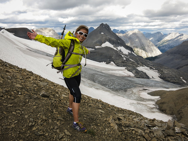
First of all, a taster of what lies ahead:

We’d all been talking about running Northover Ridge for a while. The plan had always been to do it in a day, and finally we had chosen the day. Many folks were invited, but in the end it was just the four of us who made it. Debate began about how long it might take us, what gear we should take, and how early we should leave Canmore.

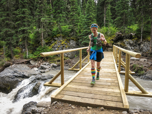
We settled on a 6am departure from Canmore, which crept a little later, and after the one hour drive down to Kananaskis Lakes, and getting gear together, it was 7.50am before we set off. We were parked at the northern carpark at Upper Kananaskis Lake. Part of the southern section of the lake was closed, so the plan was to run out and back via the north shore of Upper Kananaskis Lake.

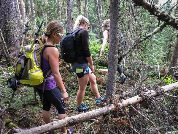
After running for a while, we hit the turn-off to Hidden Lake, and were instantly slowed to a crawl, as we clambered over, under, and through the snarl of fallen trees along the eastern shore of the lake. The trail was easy enough to follow though, just not easy going.

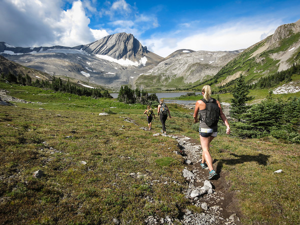
It was up and away once we reached the south of the lake, as the trail climbed steeply through the forest and out onto the open scree slopes of Mount Sarrail.

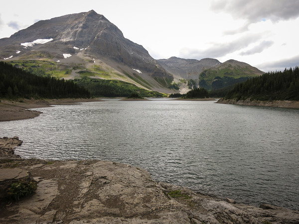
The Kananaskis Lakes shimmered in the distance behind us, and white fluffy clouds made the sky seem even bluer. We met a couple of groups on their way down from the Aster Lake campground, but by and large had the trail to ourselves, as we continued to climb up to Aster Lake.

Eventually we popped over an edge and into the Aster Lake basin. Sadly, the lake was not wildly picturesque, but instead a dingy brown colour. I am in the process of drafting a letter of complaint to Parks Canada about the poor state of their lakes.

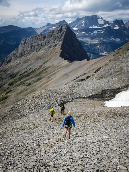
We had a brief snack stop at the lake, but then pushed onwards and upwards, around the south shore of the lake, and up the scree between Warrior Mountain and Mount Northover.

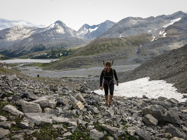
The clouds were getting a little cloudier at this point, and the breeze a little windier.

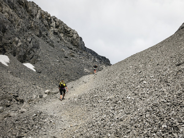
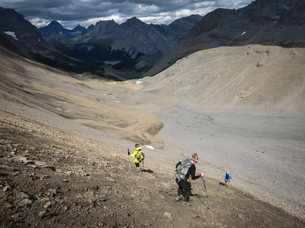
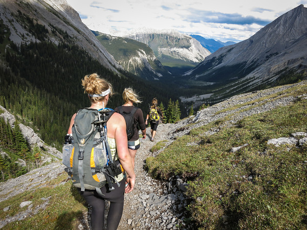
I marched along with a little trepidation, as I eyed off the clouds and the wind suspiciously, hoping neither would conspire to prevent us from being able to hike the ridge. We wouldn’t be at the half-way point of the day until we were well and truly along the ridge, so I struggled with my internal monologue, trying to find sensible justifications for continuing on no matter what the weather was doing.

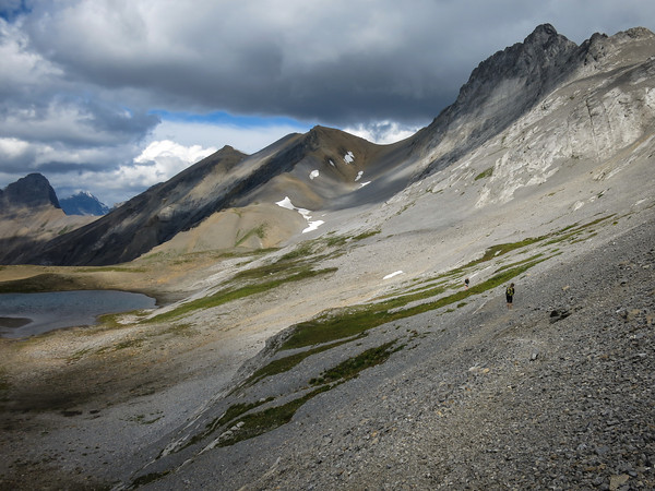
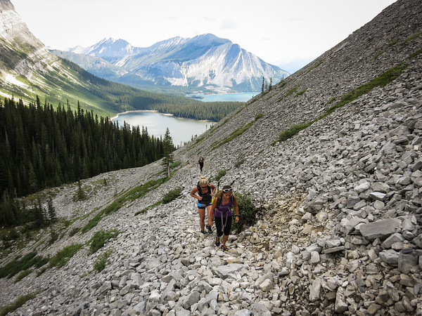
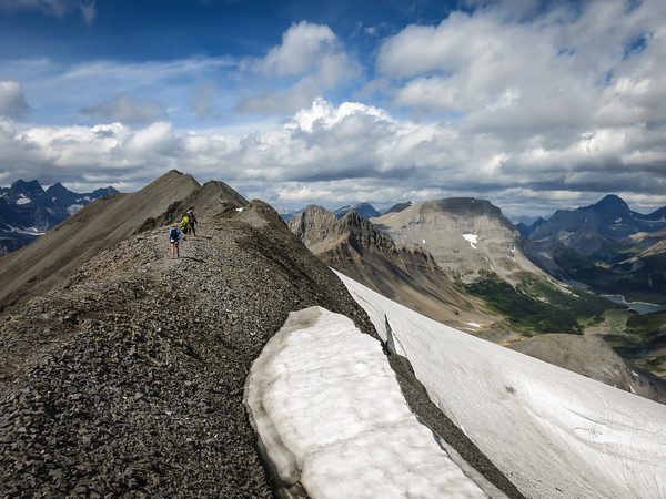
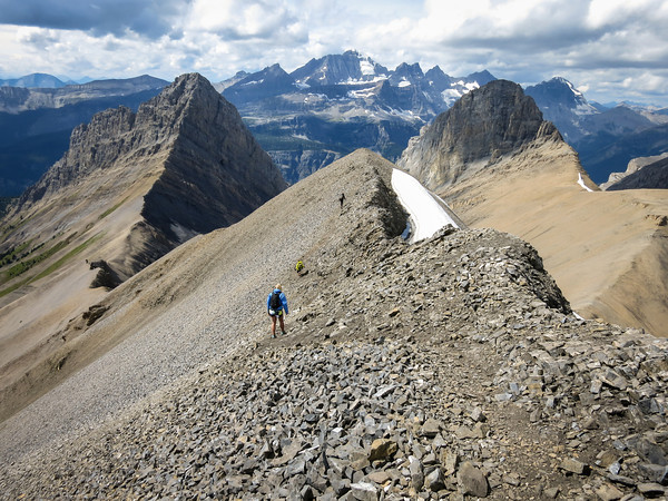
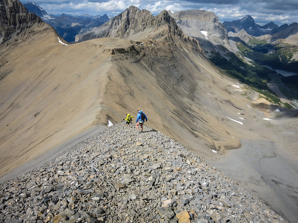
We re-grouped as we drew closer to the scree slope we would climb to gain the ridge. In the photo below you can see a couple of black dots further along the trail – we were to overtake them half way up the scree slope; they were overnight hikers travelling with enormous heavy packs. The path to the top of the ridge lay in the grey slope directly above them, although to get to the path up, you first had to traverse almost all the way to the snow.

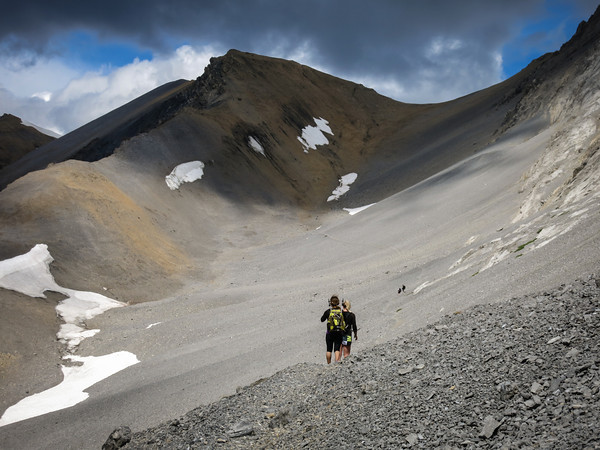
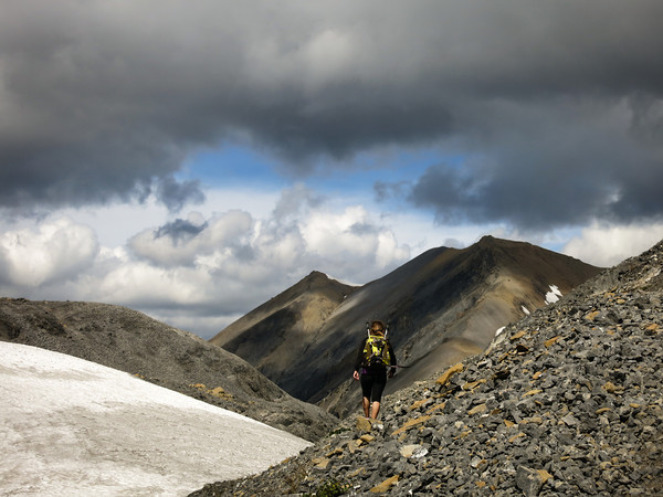
Looking back down the scree slope, towards Northover Tarns and Warrior Mountain

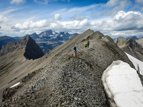
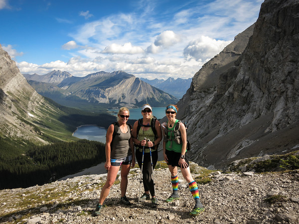
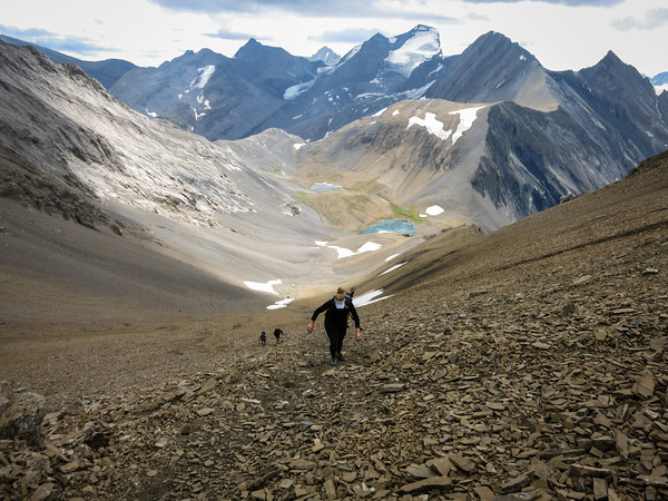
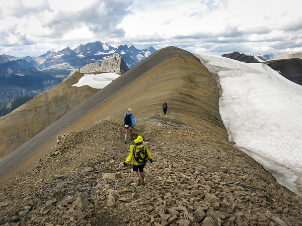
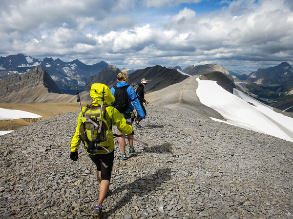
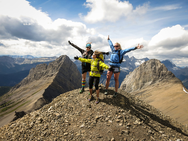
And then we were on the ridge! And it was wonderful! There was even a glacier!

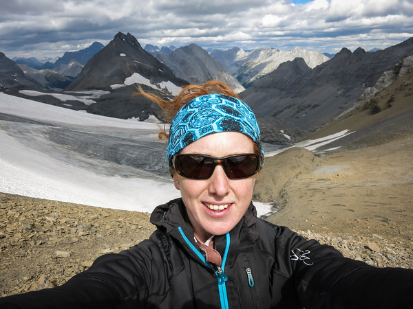
But wonders never cease, as we then got to hike along the ridge for a few more kilometres… it was largely wide enough that we could have easily been running, but we were too busy admiring the views. And trying not to be blown off.

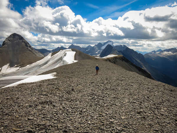
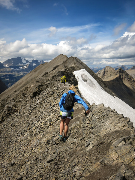
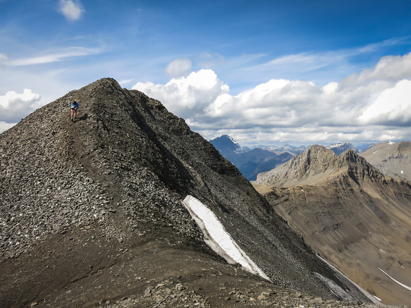
Then, sadly, it was all over. There had only been a couple of narrow points, nothing that was too tricky, although I’d probably not take anyone up there who wasn’t happy with heights and exposure.

And so, we dropped down, and said our final farewells to British Columbia (as the ridge follows the provincial lines).

An awful scree slope took us back down into Alberta. Doing the trail clockwise definitely seems like the best option.

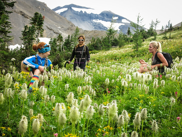
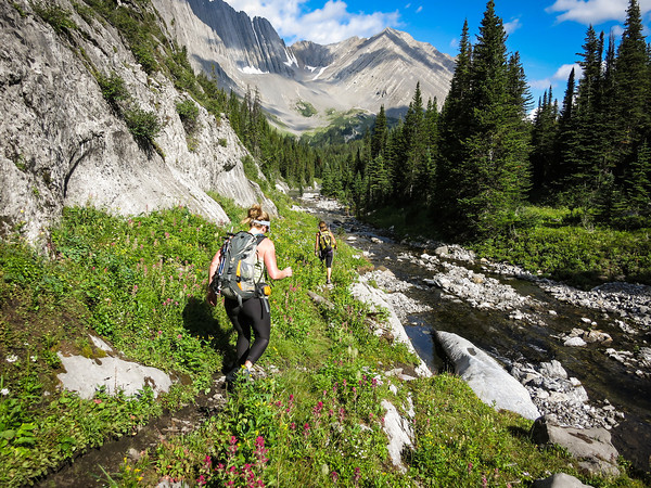
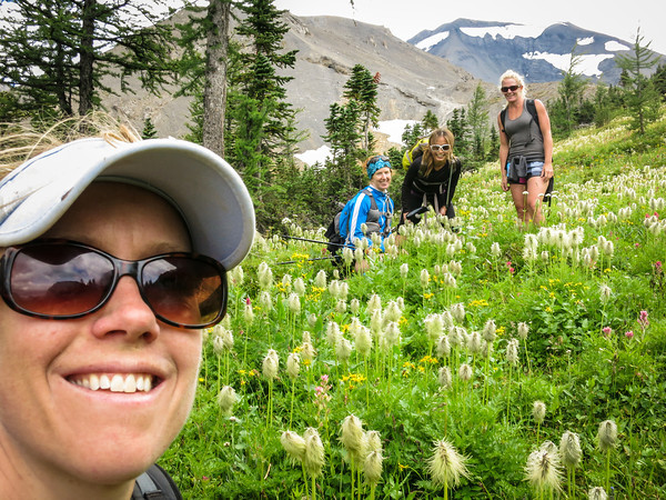
Before we dropped down to Three Isle Lake, we spent some time frolicking in a meadow full of wildflowers.

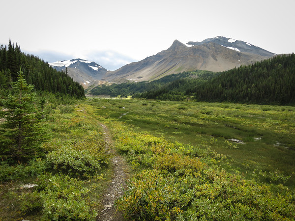
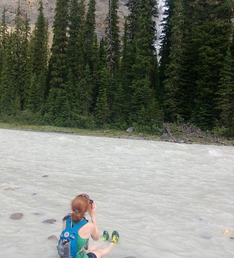
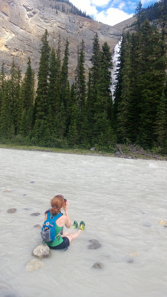
Looking back to our path travelled across the river plain

Three Isle Lake

We kept going by Three Isle Lake, and lost a lot more altitude as we followed the trail down by the flood-ravaged Three Isle Creek.

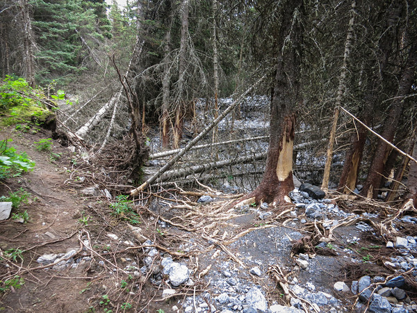
From here on, there were quite a few places where the trail had been re-routed due to flood damage.

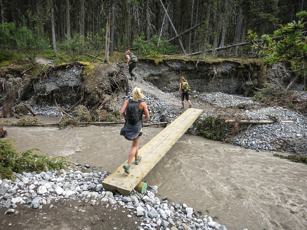
But, we started running again!

Although we eventually lost motivation over the last couple of kilometres of rough trail, and settled back into a steady plod. All of a sudden, we were at the car! And there were cupcakes, and stashed food of all sorts.

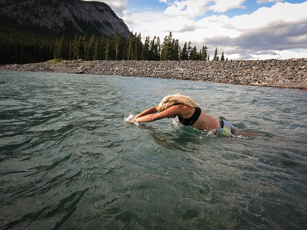
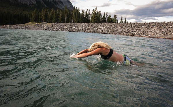
I stood waist-deep in the lake eating my cupcake. Jacket on top, but naught but underpants, socks and sneakers on my bottom half, as I stood in the water, soaking my legs for 10 minutes, to ensure they’d be feeling wonderful again tomorrow (it works wonders!). All were in awe of my trend-setting fashionista ways. Meanwhile, Kim actually jumped in for the full submersion experience.

Overall, highly recommended, five stars, would run again!

Distance: 35km
Elevation gain: 1,610m
Time: About 10 hours

Categories
canada general hiking trail running

Running the Iceline

The cunning plan for the day was to go and run the Iceline Trail in Yoho National Park. The added difficulty was having to take it in turns, so we didn’t have to tie the Moosling to a tree with nothing more than a bottle of water, a toasted cheese sandwich, and a can of bear spray to defend himself.

Alex got to run first, heading off at 8.40am from the Takkakaw Falls carpark. He headed straight up onto the Iceline from there. Meanwhile, back at the river we wandered about, threw stones, and checked out the relief map of the area. The Moosling drove stones around on the roads of the map, crashing them down to the ground from the map edge: “Oh no crash! Oh no fall, oh crash!”

11.10am and Alex was back, having taken the shorter loop option; running down past Celeste Lake and back to the car in 17.5km. So then it was my turn.

It had gotten a little warmer and a little busier on the trail by then, so I was overtaking group after group as I marched up the switchbacks then ran along the ever wonderful Iceline trail. The forecast threatened afternoon showers, but so far the clouds didn’t look too threatening, and it was only getting warmer.

I dropped down onto the trail past Celeste Lake too, running past wildflowers, and considerably less people.

But then it was up the switchbacks of doom on the Whaleback Trail. They’re fairly relentless, the sun was baking, flies were hovering about me, sweat was dripping, and there wasn’t another soul on the trail.

But then, joy! The summit! The views! And a slight breeze! It was all worthwhile.

Getting down the back of the whale wasn’t very fast going either, with lots of rocky, rooty trail with overhanging branches. Remnants of the winter snowpack were lingering on Twin Falls Creek though, and the creek itself roared along in a scenically aqua fashion.

I was a little outraged to discover there was yet more uphill ahead, as I had to skirt around before I could descend to the base of Twin Falls.

Then it was back along the Marpole Lake trail – which turned out to be full of scree and talus, and also pretty slow going. A few peeping creatures though, so it wasn’t entirely without merit. From then on I was running back along familiar territory, past Laughing Falls and then along the valley bottom, a section of trail that actually was less painful than I remember it being when we had to coax along a tired toddler at the end of the day.

Finally back at the car and ready for a nice soak in the freezing cold river.

Distance: 25.2km
Elevation gain: 1391m
Time: 3.5 hours