Mount Lady Macdonald – with an altitude of 2,606 m (8,550 ft) gives a 1200 metre elevation gain hiking from town. It was named in 1886 after Susan Agnes Macdonald, wife of Sir John A. Macdonald, the first Prime Minister of Canada (this is what wikipedia claims anyway, but there are all sorts of made-up things slipping in there these days, we all know Canada doesn’t even have a Prime Minister).
A typical 9 o’clock start had us leaving the house around 10 (we being Siggs and I, not Alex, who is stuck doing 14+ hour days at work this weekend), and walking towards Lady Mac – along a cunning short cut that actually forced us to walk uphill, and then ended up being tantalisingly close to the path we wanted, without actually reaching it. So we had to walk downhill again.
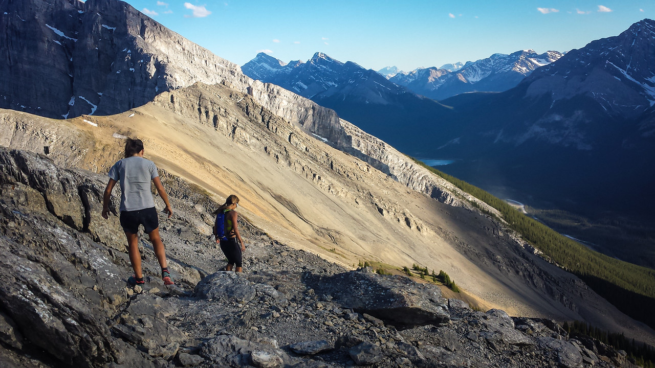
With the sore legs of people who had spent yesterday doing silly things (a 60km bike ride and hiking up Cascade mountain respectively), we hit auto-pilot on the way up, and told our legs to shut up and just keep walking.
Looking up Mount Lady Mac from the abandoned teahouse
We reached the teahouse and begun some heavy duty snacking. You could probably have even called it lunch, but for the fact we had a second one a few hours later. And the teahouse isn’t so much a teahouse as an unfinished wooden construction with lots of burn marks from where teenagers with no self-preservation have been lighting fires ON the teahouse using wood FROM the teahouse. It does provide a nice viewing and lunching platform though.

Following the teahouse there was a thankfully short slog up a scree slope until we reached the *dramatic chords* KNIFE-EDGE RIDGE. This was where I left Siggs, who has far too much common sense to be ignoring the fact she’s on a very skinny bit of rock with a definite cliff on one side, and a very steep slide on the other. There was only a light breeze, so the scramble across was actually really fun – there’s no technical difficulty to it, just the difficulty of ignoring your brain going ARGH, MY GOD IT’S A CLIFF, WE’RE ALL GOING TO DIE! Thanks to climbing I’m accustomed to my brain’s panicked warnings of impending doom. Although I didn’t stop to get my camera out along the way – I’m coordinated when it comes to not dropping me off a cliff, I have a bad track record when it comes to cameras and cliffs however.

Looking back along the ridge from the summit (this photo doesn’t really do justice to the steepness either, it’s really quite narrow at the top, though you can spend a lot of the time with your hands on the top of the ridge, walking your feet along holds on the slopey non-cliff side)
So I hit the summit – finally, that ridge seemed to go forever. Maybe it’s about 150 metres? I had Siggs at the start of it as a reference point, and she was certainly a distant blob. The journey back was quicker and easier, as I spent much less time going “Am I at the summit now? Nope, this isn’t it, maybe it’s that next bit.”
We sat at the top of the scree slope and looked down at the teahouse, helicopter pad, and Canmore while enjoying a second lunch. Followed by interminable plodding back down a path that seemed a lot less steep than it had done on the way up, and gradual removal of layers as we hit the warm valley air.