Categories
bikes canada general

One last ride for the season!

Bound to leave for a visit to Australia, I wanted to get in one last good ride before we left. Was it Felix who came up with the plan to ride this route? I can’t remember now. But we set off around 8.30 on Sunday morning, up the pass, and towards the High Rockies trail.

I’d been dreaming of trying to ride the further south section, beyond Buller. Sadly the recent snowfall gazumped that plan. But we still thought we may as well see how far we could get.

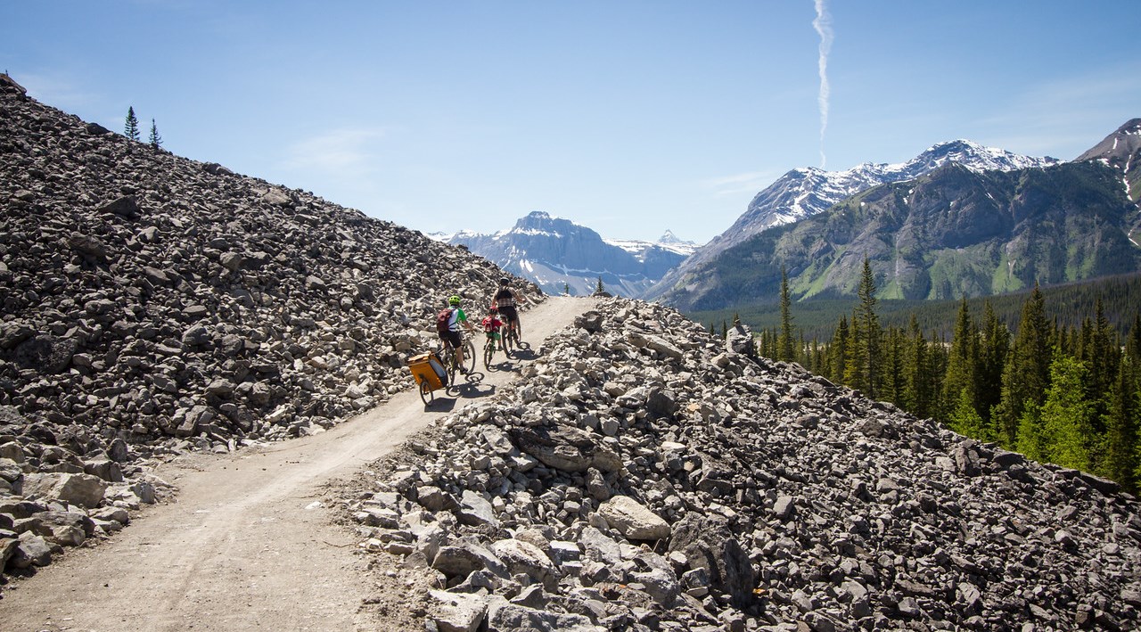
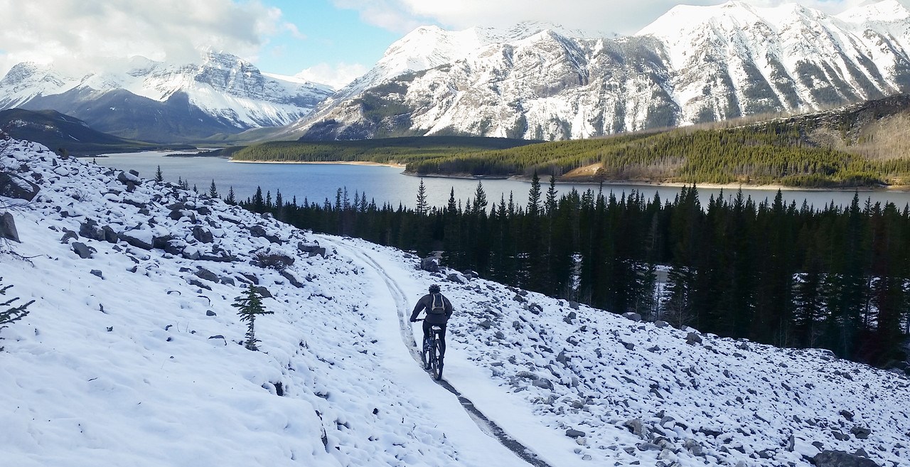
Seeing how far we could get seemed to involve quite a lot of snow, from quite early on in the day. Turning off Goat Creek, we found the High Rockies trail through the dog sled area was already snowy enough to be pretty hard work. But we’re nothing if not stubborn, and so pushed on.

Soon enough we were through to Driftwood, and onto the fun part! South of Driftwood the single track was mainly bare dirt. But as we rode further and further south, the patches of snow started to take over. By the time we hit the open scree slopes just north of Buller there was a solid base of snow on the trail.

It was still possible to ride, it just required concentration. And then more concentration. And more concentration. We were close to giving in on the final kilometre down to Buller Creek. The fat bike tracks we were following had turned back.

But no! We’re more stubborn than a couple of fat bikers. We kept going.

Then we hit the Buller trail – it was well packed, so we may as well keep going right? Ah, but then where was the turn off to the new trail? Just through the trees there, that must be it. Ohh, let’s just ride a little way… and so we rode uphill in deeper and deeper snow, until finally common sense took over, and we decided to turn back.

We’d assumed it was just hard work because of the snow, but it turns out we were climbing too. As a result, weeeeh, fun descent back to Buller Creek, snow surfing our bikes around corners, flying along! Rather fun. No photos, because we were too busy riding :)

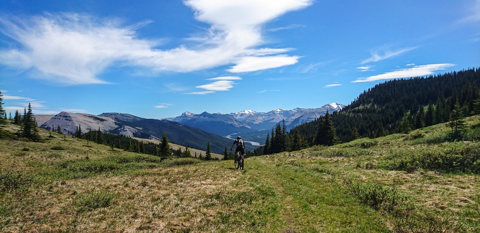
We decided to skip the snowiest sections on the way back though, and instead jumped back on the trail at Sparrowhawk, to enjoy some sweet dry singletrack on our return towards Canmore.

The aqueduct variant is really a nice option, and much more scenic and sunny than the actual High Rockies trail through this section. Recommended.

But then, we hit the pass. We could ride straight back down and go home, but there was still daylight left! And so somehow, feeling already fairly shattered from a long hard day of riding, Felix talked me into doing Riders of Rohan and the Highline as well, just to extend the ride a little more.

Thankfully he got a puncture out near Three Sisters, and so I had a valid excuse for suggesting the river trail back instead of riding Loki’s. Yes, I was that tired. Definitely a worthy final ride before the Australia trip!

Categories
canada general hiking moosling trip reports

Out from Ribbon Lake via North Buller Pass

After saying goodbye to the others, we set off towards North Buller Pass.

First, back over the bridge and up along that strip of snow that angles into the creek – none of us fell in.

Back up and over the huge snow patches *trudge trudge trudge*

I even let the boy have the camera to get a photo of us.

Wandering across to North Buller pass is a route rather than a path. We spread out and picked our way across the tussocky grass, before reaching… what’s this? Yet more snow!

Thankfully it was fairly easy to cross, although slower than we were expecting. We picked our line carefully, and then made the final steep pitch up to the pass proper.

From there we were slightly relieved to confirm that from here down it was going to be mostly just dirt and scree.

We started singing as we picked our way down, and re-entered the trees. Moving faster now, and it was starting to get warmer, and with clearer skies than there had been all weekend.

And below is where I finally confirm that the boy has inherited my weird hyper-flexing joints. Sorry Finn. He really enjoyed being the source of the waterfall though, so there’s that.

And then out out out through the wildflowers again, joining back onto the main trail that connects to South Buller Pass.

Distance: 12km
Elevation gain: 430m

Categories
canada general hiking moosling trip reports

Ribbon Lake camping

Camping at Ribbon Lake was another cunning plan of Tanya’s, come to fruition while my mother was visiting.  A bunch of us had booked camping sites up at Ribbon Lake, and four families gathered in the parking lot to hike in together.

The Ribbon Creek bridge is much further away when you’re hiking instead of riding the High Rockies trail.

There were four kids along in our group hiking in. All good little hikers, but enjoying the stops to check out the river and throw rocks into them.

Our lunch stop was at the scenic circular waterfall.

After a break to feed the starving masses, we wandered up through the burnt trees, gradually chatting and get to know each other. We knew Tanya & Mark of course, but hadn’t met the other two families before.

Almost everyone was in photo approved colours though!

As we climbing up above the treeline, we found a patch of snow! This also had to be played with.

And then a boulder for the kids to play on…

Goofballs hamming it up on top of the boulder…

The way up and over South Buller Pass was still a little snow bound, but easy to hop across, especially when you weigh under 25kg.

I always seem to end up dragging Mum out into snow, no matter how hard she tries to come in the middle of summer when there can’t possibly be any snow.  She’s a very good sport about my attempts to drag her about on mad adventures though.

The final section of scree up to the pass was clear though, and there was some scrambling on the rocks instead of walking on the trail.

We didn’t hang out for too long at the pass – it was windy! But down below we could see Ribbon Lake. We started descending steeply.

More snow! We didn’t do much glissading, but it was tempting.

This part of the descent was a little spicy. There was a steeply angled strip of snow that led into the creek. A slip would have led to coldness, wetness and possible injury. We took it carefully.

No-one slid into the snowmelt creek though! And we were marching across the bridge and along the final stretch through the trees.

We set up at camp, finding some empty tent pads, and then the boy got another lesson on tying the laces on his new shoes.

We met up with the other family there, and started cooking dinner and playing games.

Then we sent the menfolk to go and wash the dishes in the cold cold lake so we could take photos of them.

Sitting around the campfire, we read stories, ate dinner, and played Catchphrase with a neat little electronic gadget someone had brought along.

I ended up in bed fairly early – I started off there trying to get the boy to sleep, but I think I fell asleep before him.

The next morning the kids were up building forts out of the campfire wood collection – or really, just inhabiting the forts that had already been built.

Meanwhile the smaller kids brought in an engineering consult as they tried to construct a smaller house out of wood. The big bad wolf would have had them in no time.

Then it was time to say goodbye. Three families were headed onwards, to descend the chains below Ribbon Lake, pick up cars and start a lengthy car shuttle. We were headed over North Buller Pass, and another crew were headed over South Buller Pass. But no matter where we were all going, we could rest safely in the knowledge that we were all so lovely and brightly coloured that we were sure to scare off any predators that were trying to eat us.

Another fun camping weekend! And it didn’t rain that much, woo!

Distance in to Ribbon Lake via South Buller Pass: 10.5km
Elevation gain: 630m

Categories
bikes canada general moosling

Family High Rockies ride

Mostly about the photos this time round, because I’ve kind of already given the rundown of the High Rockies trail.

We stopped and had a picnic lunch at our favourite mossy spot.

There were a lot of stops to play.

And then also stops where I jumped out and went to take photos of everyone else, then dropped my lens cap in the waterfall and made the wise decision not to jump into the waterfall to rescue it.

Some bike swap action happened. The conclusion was that the boy still fits in his Singletrailer, but noone wants to pull him. And the girl kind of nearly fits on the Streamliner trail-a-bike, but not quite properly yet.

And then we were at the end of the trail where things get scenic, and I couldn’t resist taking the same photo multiple times.

Down through the burnt trees just above Buller Creek.

And then to Buller Creek, to throw rocks in.

After pedalling out to the road from Buller Creek, the menfolk bravely set out on the dusty road to fetch the cars, while the rest of us napped by the lake. And looked for fish in the lake, and threw things in the lake, and got annoyed with mosquitos. The usual.

Categories
bikes canada general trip reports

Thank you Sir, may I have another!

This is as much of a warning as anything. Do this ride if you’re up for some old-school mountain bike suffering, Kananaskis style. Glory at the deadfall you have to lift your bike over, revel in the fall line climbs, exalt at the loose fall line descents.

It’s all even better if you do it on a warm day, underestimate how long it will take, and don’t bring enough water.

We started from the based of Powderface Ridge, rode up Ford Knoll then along Ford Creek – this took a long time, and involved being beaten by a large amount of overhanging shrubbery. Then Prairie Creek, which had a lot of hikers. Then up Powderface Creek (with stops to splash water on ourselves and cool down), and then up onto Powderface Ridge – success!

Oh wait, no, it’s still a long way to get down again. And oh. God. What is this descent? It goes forever at the same angle. It’s ok, I love baby head rocks. Why would they do this to us? What is this trail? I don’t think my hands will be able to hold my breaks for much longer. Oh, there’s the car. Thank God. And Felix has cold beers in the esky – he’s a genius!

Distance: 42km
Elevation gain: 1900m