Categories
bikes general travel trip reports

Scotland: The end and the stats


  • Clamato juice is so tasty because it’s full of MSG! Excellent.
  • Glaswegians are a pack of communists.
  • Finn has developed a fear of walking around on aeroplanes.
  • Terry’s Chocolate Oranges can be purchased for £1 from Tesco!
  • Watching multiple episodes of Border Patrol on the plane is counter-productive if you’re hoping to pass through immigration in a non-furtive manner

Categories
bikes general moosling travel trip reports

Scotland: Corrieyairack Pass II

The bothy was a little chilly in the morning, but still excellent protection from the marauding midges that would have been sucking our blood, given the chance. One thing I won’t miss about Scotland is having to pick dead midges out of my eyes.

We got going by 9am, after an underwhelming breakfast of seed bread that had disintegrated entirely under the pressure of bike bag storage. The menfolk left it to me, opting to eat more structurally sound breakfast material themselves.

The climb up towards the pass from the bothy was steady, and mostly unrelentingly uphill. Steep enough to be challenging to ride loaded, but mostly not impossible.

It is an ugly valley though. The powerlines are enormous, and scar the landscape with their accompanying road. The land around them just hasn’t recovered. The windfarm sat behind us – and there’s a quarry in there too.

The sky was grey today, despite a tease of blue showing through the bothy window when we woke up.

The summit has an old concrete bunker of a hut, with a padlock on the door that’s nearly worn through from the wind blowing it back and forth. It was cold and breezy, so we took just a few photos, then headed on and down.

The descent switchbacks were rough and loose, invoking debate on the best way to ride the pass. We’re in favour of the direction we did it in, but admit to being driven a little insane by the endless drainage rock bars on the way down. They’re not as bad as the ones on the Glen Affric-Kintail section, but they still force a slow and cautious descent.

Then somehow, we were onto a narrow sealed road, although still at quite a high elevation. Still haunted by powerlines. It was mostly flat or gradually downhill, and we covered ground quickly as we moved into crofting territory.

The first town we reached was Laggan. We sat around in the little store there, charging our phones, eating cheese toasties, glorying in the delights of warm running water, and then checking out the quality of their playground infrastructure.

From there it was onto cycle route 7, but then a detour through Feshiebridge (partly because a bridge was down, and partly because it has an excellent name). Slowly onwards, back onto cycle route 7, through forest on a narrow single lane road, and into the Cairngorms to finish up a very long day.

Coming into the Cairngorms, the cycling network exploded, and we met hoards of mountain bikers. Our campground had lovely showers, lacked in phone charging stations, but made up for it in being full of other people on bikes. This was our tribe.

We debated how to spend our last day. An unloaded ride around here? Catch a train down to Edinburgh? In the end we let inertia decide, waking up to uninspiring weather and tired legs, we paid to camp for another day, and spent a day in nearby Aviemore, glorying in delicious cafe meals with dessert. We ate a meal, then browsed around town long enough to justify eating another meal. Repeat.

Oh, and the Mountain Cafe in Aviemore is highly recommended – check out the cake selection! That’s not even all of their cakes, and the food was also delicious.

Distance: 74km
Elevation gain: 780m
Location: Blackburn Bothy (Corrieyairack Pass) to Aviemore (in the Cairngorms)

Categories
bikes general moosling travel trip reports

Scotland: Corrieyairack Pass I

Corrieyairack Pass is a 770 metre high pass in the Highlands, and is known in a large part because of the military road built over it by General Wade during the Jacobite Risings in the 18th century. These days the road isn’t in great shape, but is relatively popular with hikers and cyclists.

Corrieyairack Pass was where we were headed tonight. But first, up we were headed north along the canal route, and the shores of Loch Lochy (really? were they running out of names). Undulating dirt road through mossy forest and enormous trees, forest camp sites, rope swings, ferns, flat tyres and on to Loch Oich.

We travelled alongside Loch Oich on a wildly civilised rail trail, complete with tunnel, before continuing along the Caledonian Canal.

Technically we’d been following the Caledonian Canal since we left Fort William, but this was one of the man-made sections connecting the Lochs.

Drawing close to Fort Augustus the trail was being resurfaced with an odd compacted grey stone and powder mix – it felt like a cement asphalt, but was just being laid out and compacted to set it. It was very smooth to ride on, and now I’m wishing I’d quizzed the contractors about what exactly it was. And now I feel like a massive trail geek. At least I’m not bringing up my thoughts on signage in Scottish towns.

Until we reached Fort Augustus the day had been quiet and peaceful and pleasant, with barely another person about, except for the crew of folk who were employed along the canal, opening bridges and such.

Fort Augustus lies on the end of Loch Ness, and so was swarming with tourist traffic. We lunched, resupplied, sat on the ground outside the shops and had a second lunch, ate icecream, then disappeared on our wild dirt roads and left them to their Loch Ness monster tours and stuffed toys.

The initial turn off Ardachy Road onto the Corrieyairack Pass climb was wildly overgrown with vicious prickly bushes, while a nice clear dirt road was 50 metres away, but guarded by the power company that was busy running around erecting enormous towers. The start was fairly challenging, but after a few hundred metres the evil bushes disappeared, and we were onto an open dirt road of our own, slogging uphill steeply.

It was steep climbing, but very rideable. Even loaded, I managed to clear every hill on the way to the bothy… but some of them were only just.

The midges at the bothy were ferocious. Stand still for a second and you’ll be black with them. There were also ticks living in a particular clump of bushes near the bothy. I managed to walk through it a few times before working out which area to avoid if I didn’t want to be picking 10-15 nymph ticks off me. We all ended up with ticks embedded today, and ended up resorting to improvising tweezers with two USB cable plugs, following the mysterious disappearance of our fancy new tick remover.

Random facts: Like a lot of the trip, today we were on both the Great Glen Way and the Highland 550 bikepacking race route. And there was quite a lot of good informal camping along the canals and lochs we rode along today, with signs at the locks to let you know where you can camp. And there was a decided lack of wildlife, which seems to be the theme of Scotland.
Quotes of the day from Finn: “Aeroplanes are boring for me Mama.” “Are we nearly in Banff?” “I’m five!” “I AM pedalling!!”
Distance: 49km
Elevation gain: 700m
Location: Moy Bridge – Fort William – Blackburn Bothy (Corrieyairack Pass)

Categories
bikes general moosling travel trip reports

Scotland: Glenfinnan, a munro and The Canal

We saw a fox today!

But first, packing up camp, I felt my fingers spiking and blistering from sun rash. My skin is ridiculous. I rolled my eyes at it, and was sure to put on my long gloves.

We took the coast B-Road to Ashaig. Having a brief stop at the village store, we snacked while watching a beginner group of kayakers heading out on a guided trip. Finn loudly proclaimed: “Look, they’re sailors Mama!”

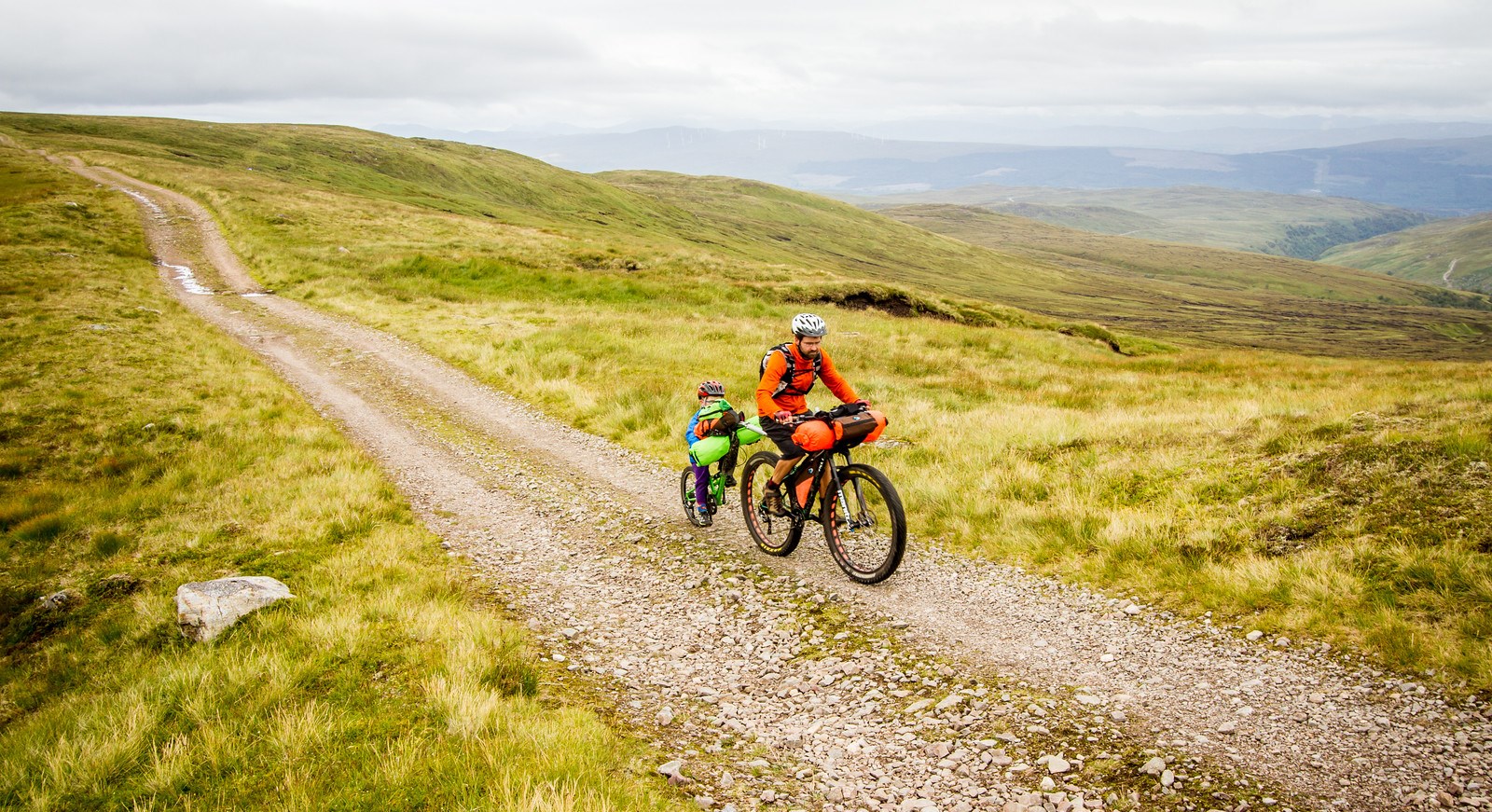
Then we cycled onto the uninspiring A-road to Glenfinnan. There was a cycle path for part of the way, but a great deal of the way it was just cycling on a shoulder.

In Glenfinnan we admired the monument, the viaduct, the gift store, and the prohibitive cost of passing urine (actually it was only 20p, but still).

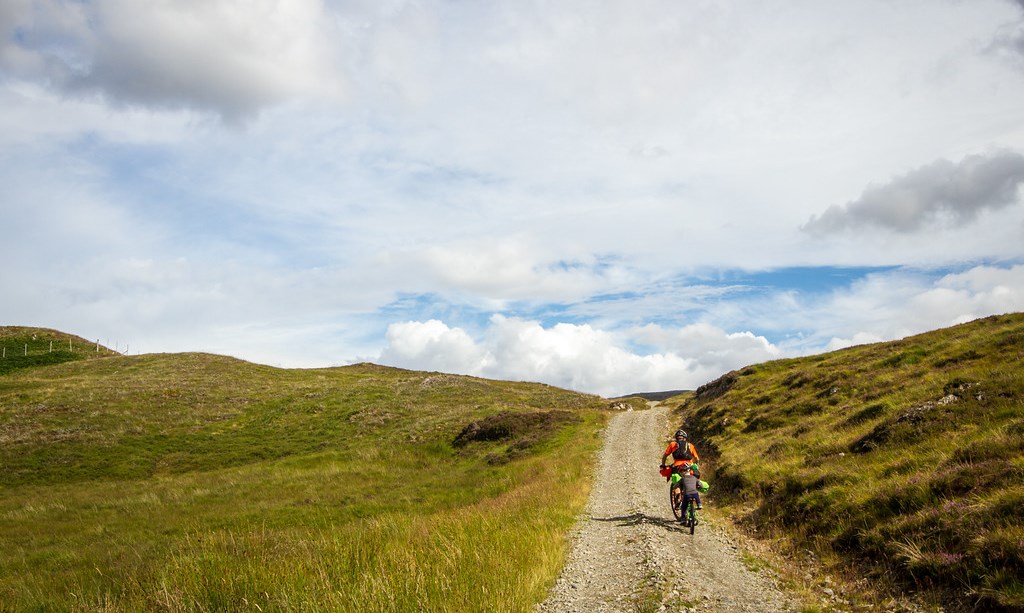
We lunched at a picnic table and admired the tour buses piling in, then cycled north and up into the quiet Glenfinnan Estate.

We reached the bothy early in the afternoon, and there was some debate about whether or not to continue, or stay the night. But the bothy magically had electricity, and the weather forecast threatened rain, and we weren’t sure of the path ahead. And so we stayed.

It was our first bothy, and was a bit reminiscent of some of the high country huts in Australia. With two small windows, graffiti, dirty wooden floorboards (and no broom), a smell of smoke, old chairs, camping tat, leftover items (a bottle of ketchup, cheap whisky, fuel that won’t work with out stove), and a guest book.

As a result of staying, we ended up parking the bikes at the bothy and going for a walk. And on the walk I found a sign for a munro. I headed back to the bothy to resupply, then off for a quick evening hike.

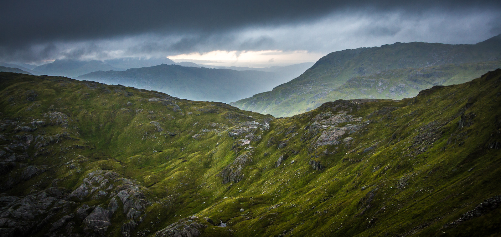
The munro in question was Sgurr nan Coireachan (3136′). The trail was boggy, and I was soon disappearing into the clouds. It felt spookily quiet, with black bogs lurking. I expected to see faces in them, trying to lure me in to peril and doom.

My feet were soon wet. Even with jumping over the puddliest of puddles and the muddiest of bogs, everything was wet, it was impossible to avoid. I was marching to the top as fast as I could, worried about the threatened rain, about Alex worrying, about the people in the black bogs getting me.

It was a lovely little hike though, although not much of a view with the clouds so low. The rain never came, and the clouds cleared a little as the sun was lowering, opening up wonderful views out to the ocean to the west. I didn’t see another soul the entire time I was out, although on the descent I did see a shovel and woollen cap abandoned by the side of the trail, which also seemed spooky at the time.

I scampered back down my munro in reasonable time, running when I could, enjoying the sensation of flying over terrain on my feet. My injured knee has stopped me running as well, and I hadn’t realised how much I missed it.

Back at the bothy was a freshly cooked meal in one of our old travel worn pots. Ah! I tell the menfolk of my adventures in the mountains, and we snuggle in the bothy, our thermarests on wooden benches, phones plugged in the charge with the inexplicable electricity. Actually, not wholly inexplicable – apparently it just came down to the fact that there needed to be a minimum number of dwellings to bother servicing an area, so the bothy was included in the count for the valley.

The next day dawned warm, clear and muggy.

We’d already decided against Plan A – which was to continue up the valley on a trail of unknown quality, and bash through to connect through with trails beyond, also of unknown quality, with an unknown time until resupply. We just didn’t have enough food with us, and the Isle of Rum adventure combined with my munro hike had wisened us up to just how boggy and slow a ‘trail’ can be.

Plan B was to ride out to Fort William on the A-road. Also with its own risks, and sadly far less adventurous.

First we stopped quickly by the Glenfinnan monument and the Harry Potter train bridge again, this time for photos!

The haul to Fort William from Glenfinnan was not terribly fun, with a busier-than-we’d-like road with no shoulder. Not as bad as Latvia, and most people were pretty good about giving us space, but we were wondering if we would have been better trying our luck with the boggy ‘shortcut’ alternative.

As we arrived in town, Finn got the chance to watch his first lock opening & closing, which he found entirely fascinating.

Finally we were into Fort William, which sucked away hours of our day as we lunched, grocery shopped, fuel-shopped, grocery shopped some more, snacked, and then finally headed out of town towards Ben Nevis.

That didn’t last long. As soon as we got out into the open we realised it was far too windy to be heading up into the alpine. I was blown off my bike!

We backtracked into town, then headed out along the canals. Flat, boring and predictable, good old canals. Past Neptune’s staircase, along the locks, we made some fast and easy kilometres.

Then just as we were thinking we’d like to stop for some dinner at least, and maybe think about finding somewhere to camp, we reached Moy Bridge.

We were just hoping to cook dinner on the picnic table there, but as I was reading the information pinned up on the board, I realised it was an informal camping spot too. Woohoo!

We set up to camp on a civilised and sheltered patch of mown grass, with lovely views – and watched as helicopters rescued climbers who were caught out by the weather on Ben Nevis.

Distance: 43km + 59km (10.7km on the munro trip)
Elevation gain: 550m + 300m (910m on the munro trip)
Location: Camusdarach Beach to Glenfinnan bothy, then to Moy Bridge (north of Fort William)

Categories
bikes general moosling travel trip reports

Scotland: The Isle of Rum

The rain has stopped. The air is still and moist, and the midges are swarming.

Our wet tent packed away, we cycle down to the ferry terminal. Onboard the ferry, bikes are lashed to a railing, and we trudge upstairs to break into our Nutella for a civilised breakfast at an actual table.

The ferry takes us to Mallaig. We aren’t sure where we’re going next, it will depend on where we can get to. Alex finds a ferry going to Rum, but we’ll have to cycle down the coast a little to get to it, it leaves from Arisaig.

There’s time to do a quick grocery shop, then we hit the road. We opt for the A-road, which is wide and quiet with a good shoulder. The B-road would be more scenic, but there isn’t time. In Arisaig it’s straight to the ferry terminal, buy one-way tickets to the Isle of Rum, then jump on the ferry.

Unlike this morning, this one is not so much a ferry as a small sight-seeing boat. It carries us, some daytrippers, and some locals off for a few days of hunting. Our bikes are dismantled and tied to the roof, and we sit watching the view from the back of the boat as we bounce along past seals and seabirds, until Finn falls asleep on my lap.

We pull up at the dock in Kinloch, Rum. The large jolly tweed-wearing Scotsmen with their large jolly Scots sons disembark first, along with their gun cases. The daytrippers dissipate quickly. We’re left alone on the dock, reassembling bikes.

Into Kinloch, we wander past a small field with horses – Finn wants to know why they don’t have horns on their heads. He’s baffled by my inability to keep a straight face, as I attempt to explain to him the difference between unicorns and horses.

The Isle of Rum is one of the Small Isles, and its thirty or so residents all live in Kinloch. It’s been inhabited since around 8000BC, with neolithic folks, early Christians, Norse, various Scots clans, and finally crofters. The crofters lived here until 1826 when they were largely packed off and sent to Cape Breton, Nova Scotia so a man could turn the island into a sheep farm. That failed miserably, and the island was eventually sold to the Marquess of Salisbury who converted it into a sporting estate, which eventually had a castle built on it (fourteen under-gardeners worked on the grounds and were paid extra to wear kilts). It was finally sold to Scottish Natural Heritage, to become a national nature reserve.

A very wet nature reserve, with an average annual rainfall of 120 inches.

Riding out of Kinloch, we don’t see anyone else for the next 24 hours. It’s wonderfully deserted. We pedal first along the dirt road and then start pushing our bikes up the steep and boggy path. The plan had been to see if we could get to Dibidil Bothy. It starts to look unlikely. Without Finn, we would have more of a chance, but his trail-a-bike makes everything harder, and Finn himself is very mistrustful of this boggy ground after the incident in Glen Affric. It’s slow going, and very wet.

We watch a group of red deer, as we make our way up to the saddle that marks the middle of the Isle. From here we can see out to the ocean on both sides of the island, and decide it’s as good a place to camp as any. It’s cloudy, with patches of rain, but there are glimpses of blue sky around. The wind is light, and the weather forecast is good.

We set up camp, cook dinner, and get Finn to sleep. I’ve been experimenting with trying to manage without a sleeping mat, but find I always get too cold after a couple of hours. I’m listening to the audiobook of Trainspotting, by Irvine Welsh. It’s really well read, and I’m enjoying the story, but it feels out of place in our current surrounds.

Then the wind picks up and changes direction. It starts to rain. I start having flashbacks to reading tent reviews before buying our Big Agnes Copper Spur UL3 tent – it performs poorly in windy conditions. This is confirmed as Alex and I take it in turns to sit bracing the side pole that’s dipping and bowing, coming dangerously close to snapping. On our long European cycle tour, we had a Big Agnes Seedhouse SL2 tent that had a few poles snap. They’re great tents, but the lightweight poles come at a price.

Around midnight a few pegs pull loose and the tent starts snapping wildly in the wind. Alex lunges out into the rain and starts trying to stabilise it with rocks. We debate the merits of re-orienting the tent where we are but decide the wind is too strong and doesn’t show any sign of abating. Instead, we make the call to relocate. I sit up, bracing the tent, as Alex scouts out a better spot. Confirmed – we can move to the lee of the rock we’re camping above.

I get Finn dressed in his rain gear. He’s unimpressed at being woken and doesn’t want to stay put when I carry him to the proposed new tent spot.

I empty the heavy items out of the tent, we unpeg it, wait for a lull, then run it down to the new spot. Re-peg. Re-insert child and other items into tent. Although it’s wet and windy, it’s not cold at all. Thankfully.

With everyone inside the newly erected tent, I find a spot for Finn. We curl up and relax, the tent seems properly sheltered here. Although it’s far from flat ground – the four corners of the tent plunge deeply, and finding a place to sleep is more about nesting.

Finn largely takes the whole episode as a matter of course, just saying in the morning: “When we’re in my place Mama, we don’t get up in the night to move things.”

After packing up camp the next morning, the trail-a-bike gets a flat tyre within a few hundred metres. After that hiccup, we find it’s much faster going – a good chunk of the terrain is actually rideable on the way down.

We have time to kill, so wander over to Kilmory Bay before backtracking out through Kinloch Glen to lunch in the community hall. There we sit awkwardly and drink coffee from mugs that look like they’ve been in the hall since the 1970s. I worry that the world might end and we’ll be stuck on the Isle of Rum forever. It feels a little as if time doesn’t really touch it, and perhaps the world has already ended.

The ferry is late, and I wonder again if the world has ended. But all is well and eventually, the ferry arrives and takes us back to Massaig. It’s raining, and we gleefully splurge on fish and chips before riding to Camusdarach Beach. They let us into the campground there despite being full, and we watch the sun as it sets over the Isle of Eigg and the Isle of Rum.

Distance: 23km on the mainland, 23km on the Isle of Rum
Elevation gain: 300m on the mainland, 340m on Rum
Location: Mallaig to Arisaig, ferry to the Isle of Rum, then ferry back to Mallaig, and a wander down the coast to Camusdarach Beach